MyTopo
New Albany Kansas US Topo Map
Couldn't load pickup availability
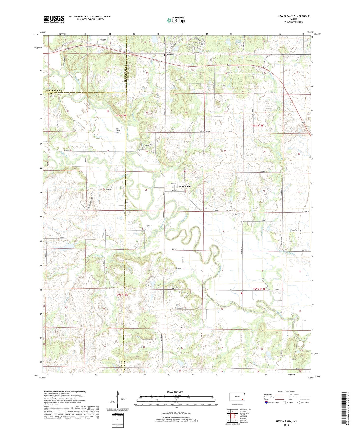
2022 topographic map quadrangle New Albany in the state of Kansas. Scale: 1:24000. Based on the newly updated USGS 7.5' US Topo map series, this map is in the following counties: Wilson, Elk, Greenwood. The map contains contour data, water features, and other items you are used to seeing on USGS maps, but also has updated roads and other features. This is the next generation of topographic maps. Printed on high-quality waterproof paper with UV fade-resistant inks.
Quads adjacent to this one:
West: Fall River
Northwest: Fall River Lake
North: Coyville
Northeast: Middletown
East: Fredonia
Southeast: Lafontaine
South: Buxton
Southwest: Longton
This map covers the same area as the classic USGS quad with code o37095e8.
Contains the following named places: Cedar Hollow, City of New Albany, Coon Creek, Delaware Springs, Fanchier Valley School, Forty Four School, Gardner School, Green Valley School, Indian Creek, Jackson Cemetery, Lakeside Airport, Needmore School, New Albany, New Albany United Methodist Church, Old Tailor Cemetery, Pleasant Point School, Pleasant Valley School, Saint Francis Cemetery, Saint Francis Church, Shawnee Creek, Silver Creek, Silver Creek School, Teeters Branch, Ten Penny School, Township of Fall River, Weakley Cemetery, Willow Creek, Wilson County Rural Fire District Station 3, Wilson County Rural Fire District Station 7