MyTopo
Phenis Creek Kansas US Topo Map
Couldn't load pickup availability
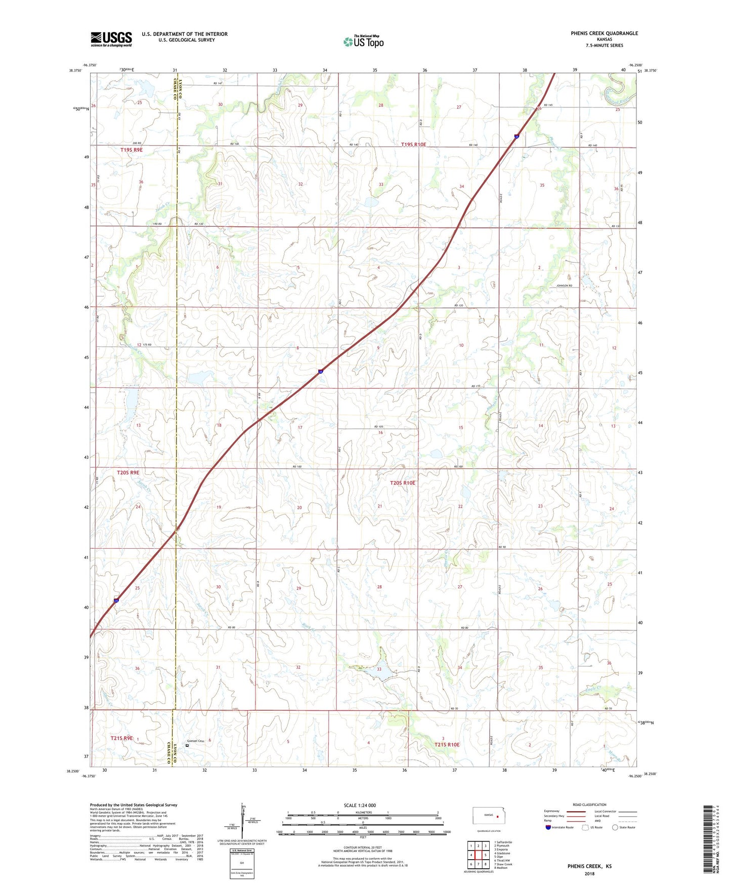
2022 topographic map quadrangle Phenis Creek in the state of Kansas. Scale: 1:24000. Based on the newly updated USGS 7.5' US Topo map series, this map is in the following counties: Lyon, Chase. The map contains contour data, water features, and other items you are used to seeing on USGS maps, but also has updated roads and other features. This is the next generation of topographic maps. Printed on high-quality waterproof paper with UV fade-resistant inks.
Quads adjacent to this one:
West: Gladstone
Northwest: Saffordville
North: Plymouth
Northeast: Emporia
East: Olpe
Southeast: Madison
South: Shaw Creek
Southwest: Thrall NW
This map covers the same area as the classic USGS quad with code o38096c3.
Contains the following named places: Central City, Ebenezer United Methodist Church, Goessel Cemetery, Plumb, Wagaman Farms