MyTopo
Manchester NW Kansas US Topo Map
Couldn't load pickup availability
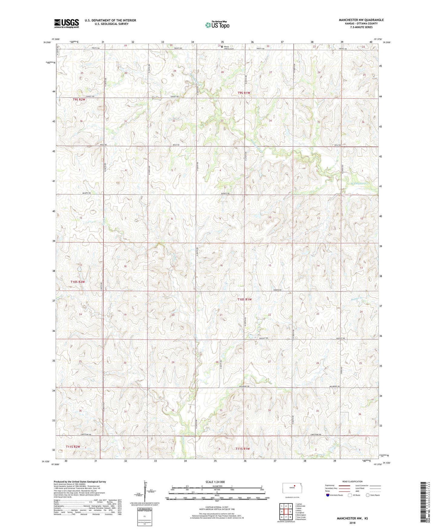
2022 topographic map quadrangle Manchester NW in the state of Kansas. Scale: 1:24000. Based on the newly updated USGS 7.5' US Topo map series, this map is in the following counties: Ottawa. The map contains contour data, water features, and other items you are used to seeing on USGS maps, but also has updated roads and other features. This is the next generation of topographic maps. Printed on high-quality waterproof paper with UV fade-resistant inks.
Quads adjacent to this one:
West: Wells
Northwest: Lamar
North: Miltonvale
Northeast: Idana
East: Longford
Southeast: Manchester
South: Vine Creek
Southwest: Bennington
This map covers the same area as the classic USGS quad with code o39097b4.
Contains the following named places: Antioch Church, Bethany Church, Braid, Condray Airport, Jefferson Point State Park, Mount Liberty Church Cemetery, Mount Liberty United Methodist Church, Sun Valley Church, Township of Durham, Union School, Widerange