MyTopo
Wells Kansas US Topo Map
Couldn't load pickup availability
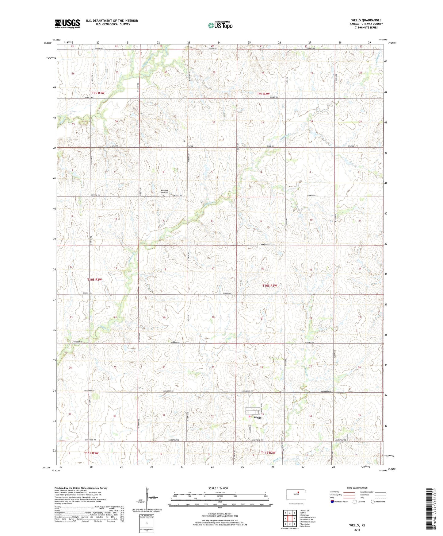
2022 topographic map quadrangle Wells in the state of Kansas. Scale: 1:24000. Based on the newly updated USGS 7.5' US Topo map series, this map is in the following counties: Ottawa. The map contains contour data, water features, and other items you are used to seeing on USGS maps, but also has updated roads and other features. This is the next generation of topographic maps. Printed on high-quality waterproof paper with UV fade-resistant inks.
Quads adjacent to this one:
West: Minneapolis North
Northwest: Aurora SW
North: Lamar
Northeast: Miltonvale
East: Manchester NW
Southeast: Vine Creek
South: Bennington
Southwest: Minneapolis South
This map covers the same area as the classic USGS quad with code o39097b5.
Contains the following named places: Middle Pipe Creek, Ottawa County Rural Fire District 4 Wells Station, Pleasant Hill Cemetery, Siler Airport, Sunset Spiritualist Church, Township of Grant, Wells, Wells Census Designated Place