MyTopo
McLouth Kansas US Topo Map
Couldn't load pickup availability
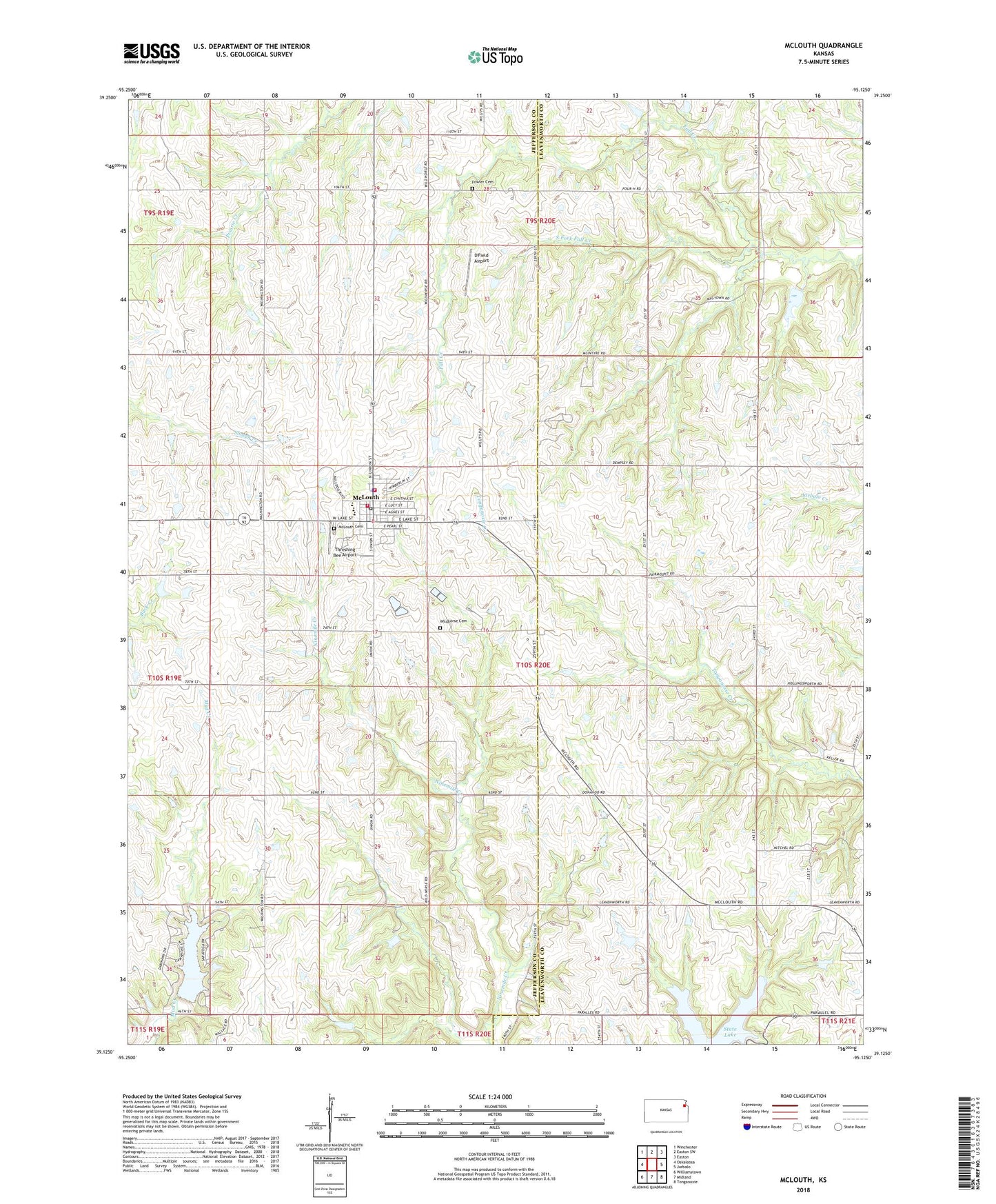
2022 topographic map quadrangle McLouth in the state of Kansas. Scale: 1:24000. Based on the newly updated USGS 7.5' US Topo map series, this map is in the following counties: Jefferson, Leavenworth. The map contains contour data, water features, and other items you are used to seeing on USGS maps, but also has updated roads and other features. This is the next generation of topographic maps. Printed on high-quality waterproof paper with UV fade-resistant inks.
Quads adjacent to this one:
West: Oskaloosa
Northwest: Winchester
North: Easton SW
Northeast: Easton
East: Jarbalo
Southeast: Tonganoxie
South: Midland
Southwest: Williamstown
This map covers the same area as the classic USGS quad with code o39095b2.
Contains the following named places: Brown Grove School, Brown School, City of McLouth, D'Field Airport, Dorei Airport, Eagle Springs, Fowler Cemetery, Jefferson County Fire Department District 9, Lake Dabanawa, Leavenworth County State Park, Mc Louth Cemetery, McLouth, McLouth Elementary School, McLouth Fire Department, McLouth High School, McLouth Medical Clinic, McLouth Middle School, McLouth Police Department, McLouth Post Office, McLouth Public Library, McLouth Sewer Treatment Plant, McLouth Unified School District Offices, Midway, South Fork Fall Creek, Stanwood, Stanwood Friends Church, Stanwood School, Threshing Bee Airport, Township of Tonganoxie, Township of Union, Wild Horse School, Wildhorse Cemetery, Woodstock, Woodstock School, ZIP Code: 66054