MyTopo
Williamstown Kansas US Topo Map
Couldn't load pickup availability
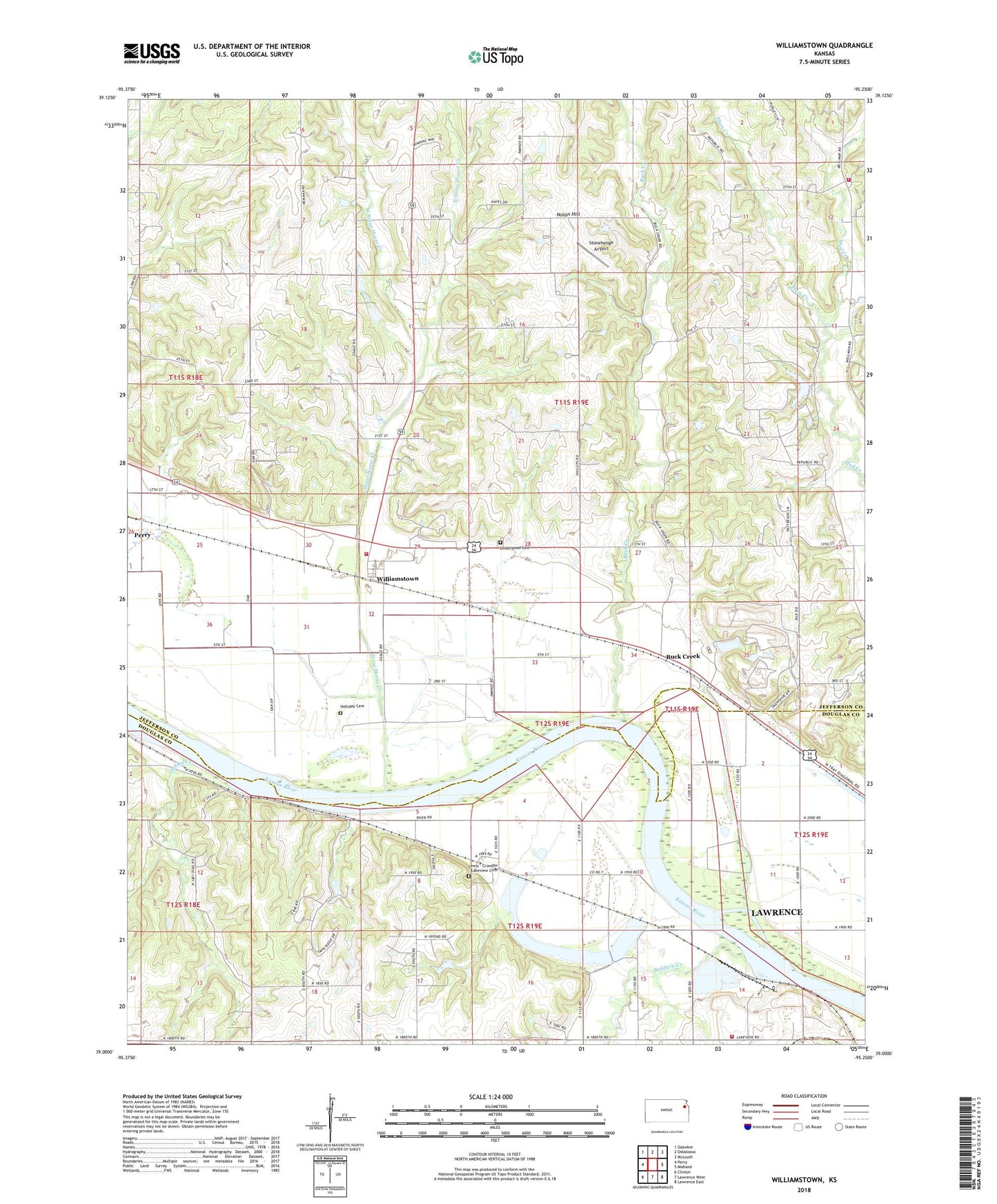
2022 topographic map quadrangle Williamstown in the state of Kansas. Scale: 1:24000. Based on the newly updated USGS 7.5' US Topo map series, this map is in the following counties: Jefferson, Douglas. The map contains contour data, water features, and other items you are used to seeing on USGS maps, but also has updated roads and other features. This is the next generation of topographic maps. Printed on high-quality waterproof paper with UV fade-resistant inks.
Quads adjacent to this one:
West: Perry
Northwest: Ozawkie
North: Oskaloosa
Northeast: McLouth
East: Midland
Southeast: Lawrence East
South: Lawrence West
Southwest: Clinton
This map covers the same area as the classic USGS quad with code o39095a3.
Contains the following named places: Baldwin Creek, Buck Creek, Buck Creek School, Chester, Clover Hill School, Dean School, East Stone House Creek, Holliday Cemetery, Lake View, Lake View Lake, Lake View Station, Lewis - Crowder - Lakeview Cemetery, Nolan Hill, Oakley Creek, Perry United Methodist Church, Plum Creek, Rural Township Fire Department, Sarcoxie Township Fire District 4 North Station, Stone Horse Creek, Stonehenge Airport, Sunnyside School, Township of Rural, Underwood Cemetery, Wakarusa Township Fire Station 2, West Stone House Creek, Williamstown, Williamstown Assembly of God Church, Williamstown Census Designated Place, Winters School, ZIP Code: 66073