MyTopo
Oskaloosa Kansas US Topo Map
Couldn't load pickup availability
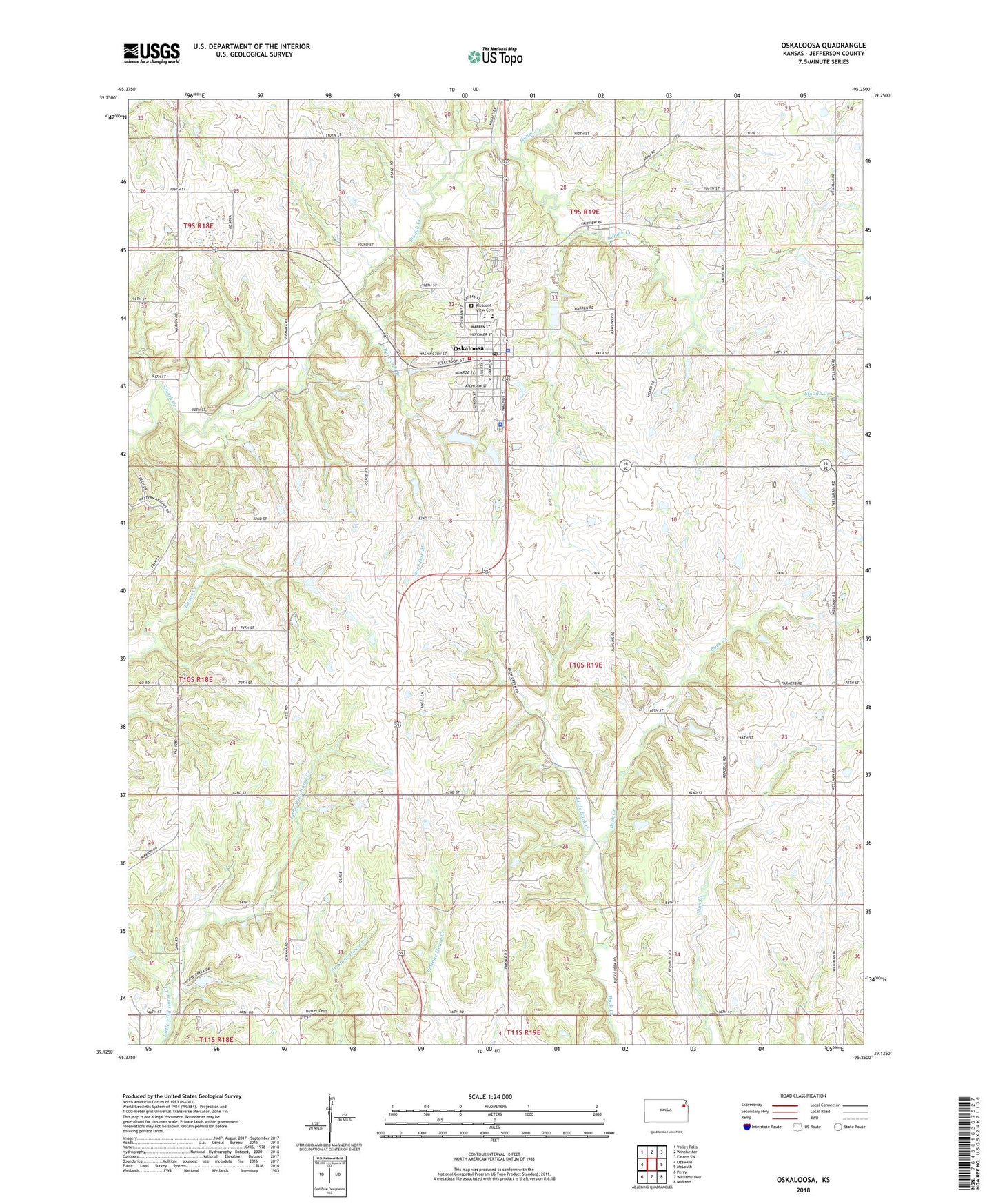
2022 topographic map quadrangle Oskaloosa in the state of Kansas. Scale: 1:24000. Based on the newly updated USGS 7.5' US Topo map series, this map is in the following counties: Jefferson. The map contains contour data, water features, and other items you are used to seeing on USGS maps, but also has updated roads and other features. This is the next generation of topographic maps. Printed on high-quality waterproof paper with UV fade-resistant inks.
Quads adjacent to this one:
West: Ozawkie
Northwest: Valley Falls
North: Winchester
Northeast: Easton SW
East: McLouth
Southeast: Midland
South: Williamstown
Southwest: Perry
This map covers the same area as the classic USGS quad with code o39095b3.
Contains the following named places: Bethel Church, Buck Point School, Burr Oak Branch, Buster Cemetery, C A J Dairy Farms, Central Chapel, City of Oskaloosa, Dick School, Hickory Pointe Care and Rehabilitation Center, Hinton School, Honey Creek, Jefferson County Ambulance Service, Jefferson County Courthouse, Jefferson County Health Department, Jefferson County Jail, Jefferson County Sheriff's Office, Kingdom Hall of Jehovahs Witnesses, Leaverton School, Little Buck Creek, Living Water Evangelical Free Church, McIntosh, Midway Chapel, Natural Resources Conservation Service Oskaloosa Service Center, Oskaloosa, Oskaloosa Church of Christ, Oskaloosa City Hall, Oskaloosa Elementary School, Oskaloosa Fire District 8, Oskaloosa First Baptist Church, Oskaloosa First Presbyterian Church, Oskaloosa First United Methodist Church, Oskaloosa Junior - Senior High School, Oskaloosa Middle School, Oskaloosa Police Department, Oskaloosa Post Office, Oskaloosa Public Library, Oskaloosa Public Schools District Office, Oskaloosa Water Treatment Plant, Parsons School, Pleasant View Cemetery, Shomin Airport, Shomin Industrial Park, Township of Oskaloosa, Wellman School, ZIP Code: 66066