MyTopo
Minneapolis North Kansas US Topo Map
Couldn't load pickup availability
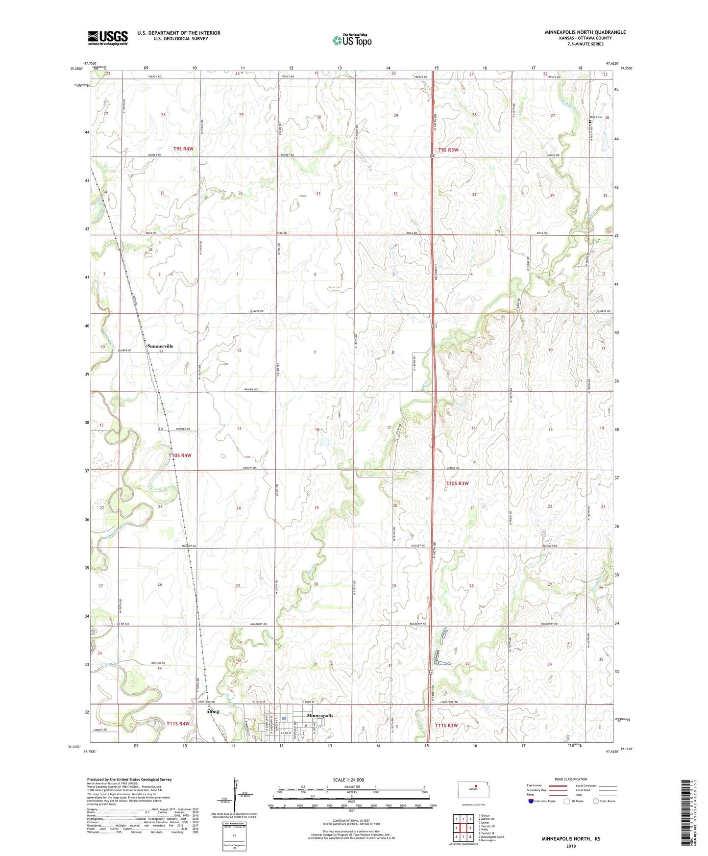
2022 topographic map quadrangle Minneapolis North in the state of Kansas. Scale: 1:24000. Based on the newly updated USGS 7.5' US Topo map series, this map is in the following counties: Ottawa. The map contains contour data, water features, and other items you are used to seeing on USGS maps, but also has updated roads and other features. This is the next generation of topographic maps. Printed on high-quality waterproof paper with UV fade-resistant inks.
Quads adjacent to this one:
West: Tescott NE
Northwest: Glasco
North: Aurora SW
Northeast: Lamar
East: Wells
Southeast: Bennington
South: Minneapolis South
Southwest: Tescott SE
This map covers the same area as the classic USGS quad with code o39097b6.
Contains the following named places: Alfmil, Baldock Farm Airport, Community Bible Church, Hall Cemetery, Hall Wesleyan Church, Highway View School, Kansas Department of Transportation District 2, Minneapolis Free Methodist Church, Minneapolis Junior / Senior High School, Minneapolis Public Library, New Beginnings Christian Fellowship, Ottawa County, Ottawa County Health Center, Ottawa County Health Department, Sumnerville, Township of Blaine, West Pipe Creek, ZIP Code: 67467