MyTopo
Valley Falls Kansas US Topo Map
Couldn't load pickup availability
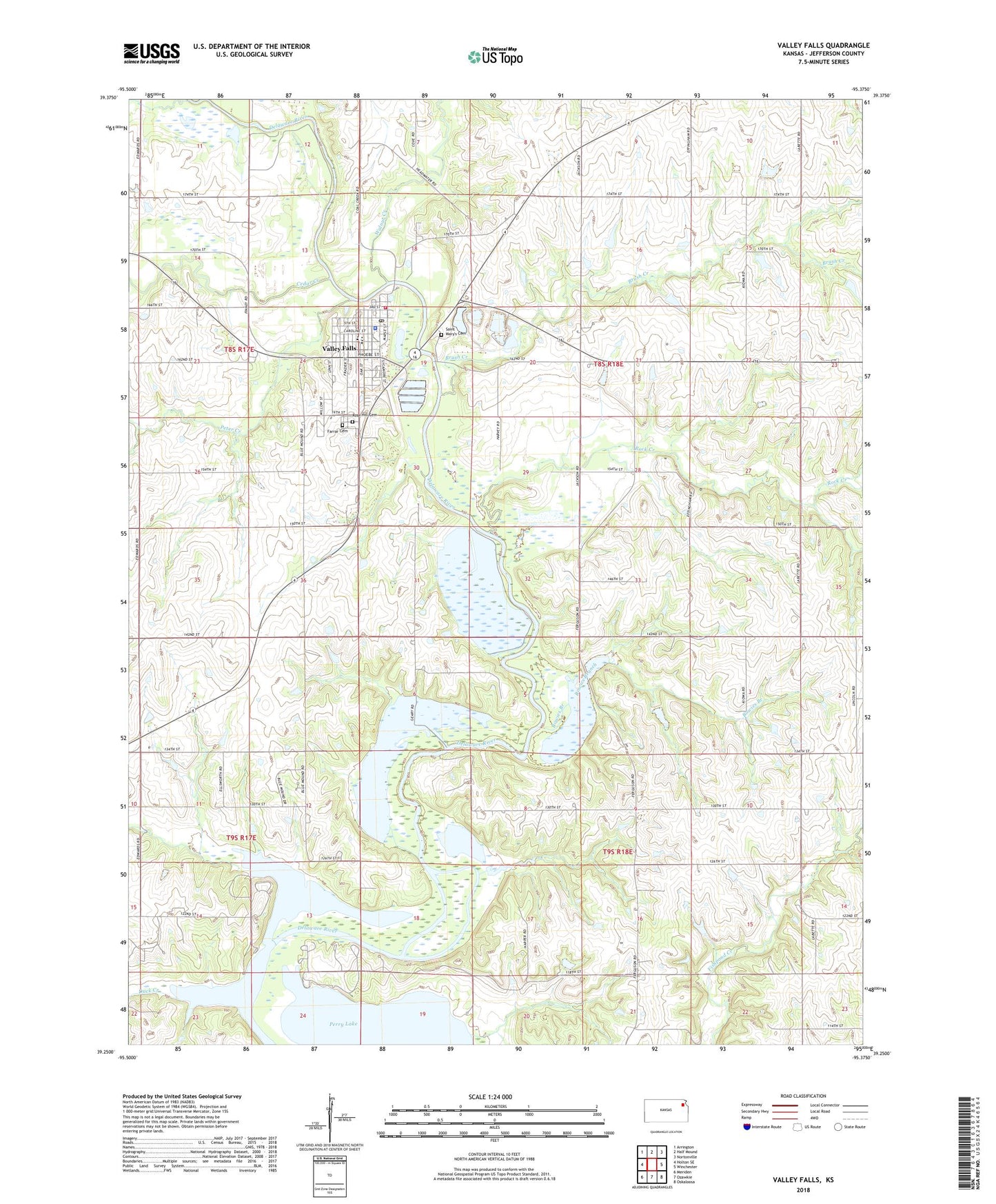
2022 topographic map quadrangle Valley Falls in the state of Kansas. Scale: 1:24000. Based on the newly updated USGS 7.5' US Topo map series, this map is in the following counties: Jefferson. The map contains contour data, water features, and other items you are used to seeing on USGS maps, but also has updated roads and other features. This is the next generation of topographic maps. Printed on high-quality waterproof paper with UV fade-resistant inks.
Quads adjacent to this one:
West: Holton SE
Northwest: Arrington
North: Half Mound
Northeast: Nortonville
East: Winchester
Southeast: Oskaloosa
South: Ozawkie
Southwest: Meriden
This map covers the same area as the classic USGS quad with code o39095c4.
Contains the following named places: Bowies Branch, Brush Creek, Calvary Baptist Church, Cedar Creek, City of Valley Falls, Delaware Township Library, Duck Creek, Farrar Cemetery, First Christian Church, French Creek, Linnwood Place Assisted Living Facility, McConnaugheys Mobile Home Park, Nesbitt School, Paradise Point Public Use Area, Perry Wildlife Area, Peter Creek, Rock Creek, Rose Hill Cemetery, Saint Mary's Cemetery, Saint Marys Immaculate Conception Church, Saint Paul Lutheran Church, Sunset Ridge Public Use Area, Township of Delaware, Township of Ozawkie, Valley Falls, Valley Falls City Hall, Valley Falls Elementary School, Valley Falls Fairgrounds, Valley Falls Fire Department, Valley Falls High School, Valley Falls Historical Society Museum, Valley Falls Middle School, Valley Falls Police Department, Valley Falls Post Office, Valley Falls Unified School District Office, Valley Falls United Methodist Church, Valley Falls Wastewater Treatment Plant, Valley Falls Water Tower, Walnut Creek, ZIP Code: 66088