MyTopo
Ogden Kansas US Topo Map
Couldn't load pickup availability
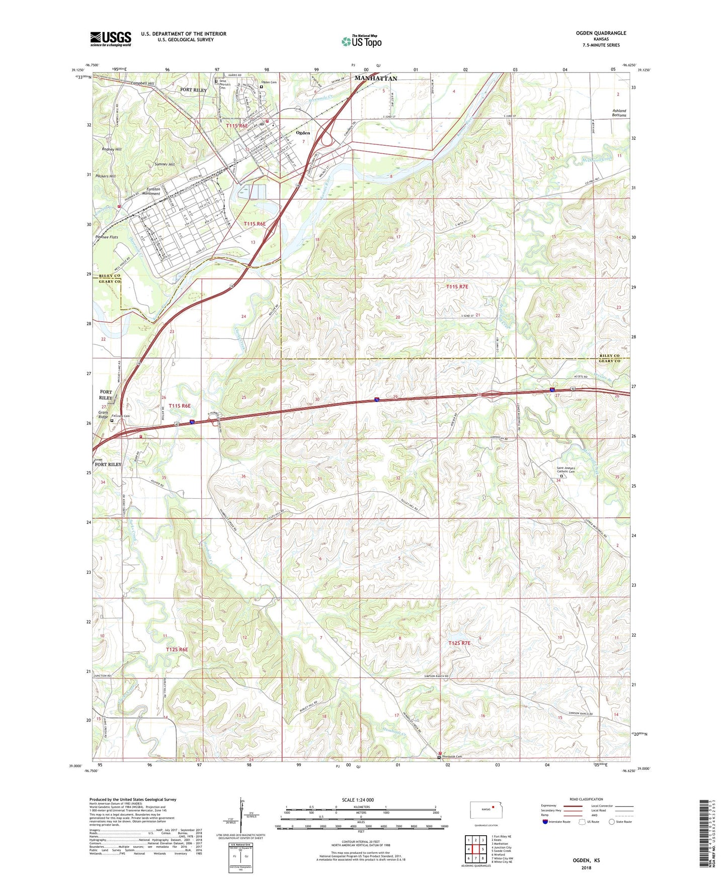
2022 topographic map quadrangle Ogden in the state of Kansas. Scale: 1:24000. Based on the newly updated USGS 7.5' US Topo map series, this map is in the following counties: Geary, Riley. The map contains contour data, water features, and other items you are used to seeing on USGS maps, but also has updated roads and other features. This is the next generation of topographic maps. Printed on high-quality waterproof paper with UV fade-resistant inks.
Quads adjacent to this one:
West: Junction City
Northwest: Fort Riley NE
North: Keats
Northeast: Manhattan
East: Swede Creek
Southeast: White City NE
South: White City NW
Southwest: Wreford
This map covers the same area as the classic USGS quad with code o39096a6.
Contains the following named places: Ashwood Mobile Home Park, Berry School, Camp Funston, Campbell Hill, City of Ogden, Clarks Creek, Dry Branch, Enterprise School, Fairview Cemetery, Forsyth Creek, Fort Riley Fire Department Station 4, Funston Monument, Geary County Rural Fire Department Station 4, Geary County Rural Fire Department Station 6, Humboldt Cemetery, Humboldt Creek, Humboldt School, J and L Mobile Home Park, Korean Presbyterian Church, McDowell Creek School, Midwest Raceway, Ogden, Ogden Baptist Church, Ogden Bible Church, Ogden Cemetery, Ogden City Hall, Ogden Community Center, Ogden Elementary School, Ogden Fire Station, Ogden Friendship House United Methodist Church, Ogden Post Office, Ogden Public Library, Ogden Wastewater Treatment Facility, Packers Camp, Packers Hill, Pressee Branch, Riley County Police Department Ogden Substation, Rodney Hill, Saint Joseph Cemetery, Saint Josephs Church, Saint Patricks Catholic Church, Saint Patricks Cemetery, Sumner Hill, Tally School, Threemile Creek, Township of Ogden, Township of Wingfield, Tully School, Walnut Grove School, Whiskey Lake, ZIP Code: 66517