MyTopo
Keats Kansas US Topo Map
Couldn't load pickup availability
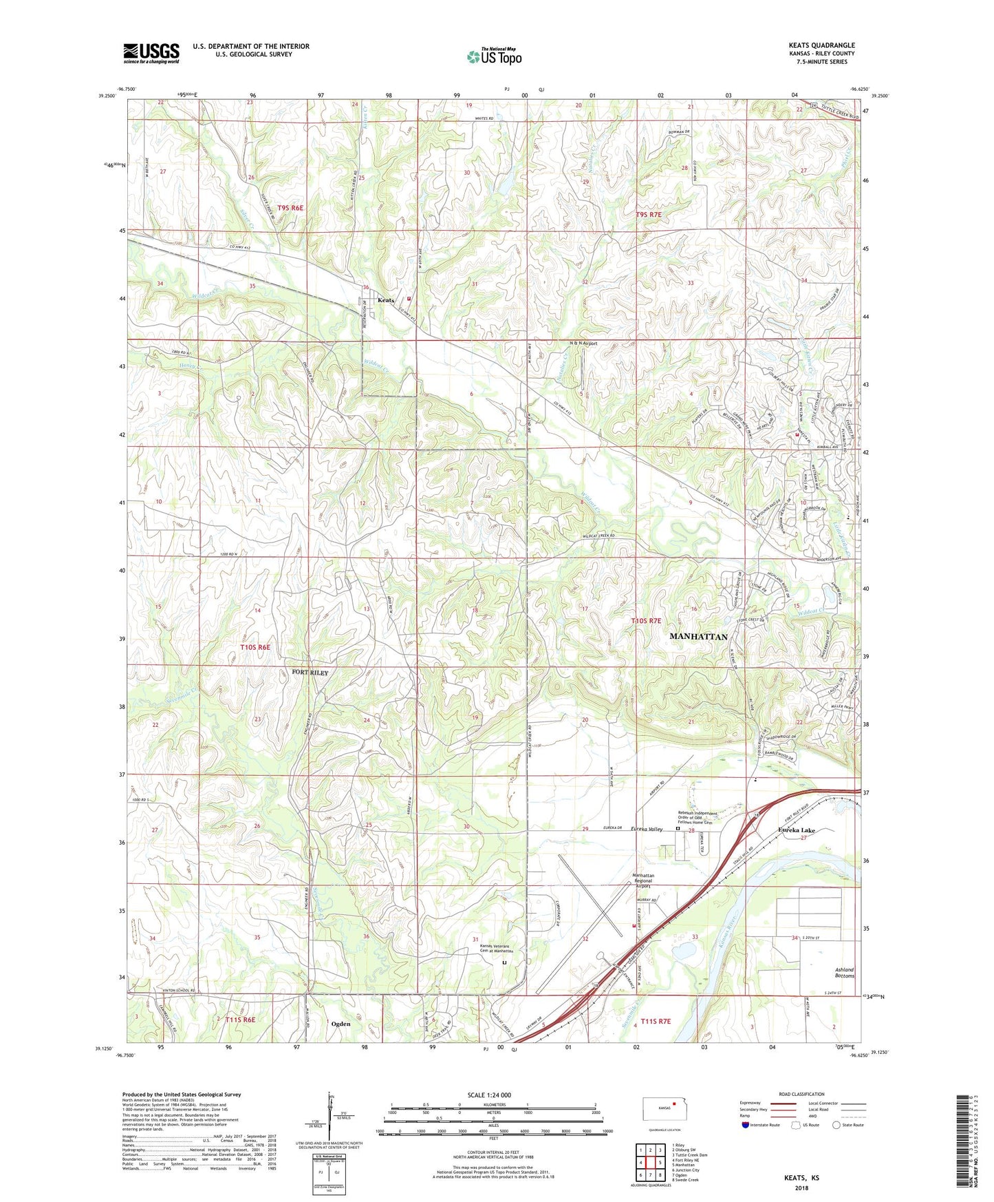
2022 topographic map quadrangle Keats in the state of Kansas. Scale: 1:24000. Based on the newly updated USGS 7.5' US Topo map series, this map is in the following counties: Riley. The map contains contour data, water features, and other items you are used to seeing on USGS maps, but also has updated roads and other features. This is the next generation of topographic maps. Printed on high-quality waterproof paper with UV fade-resistant inks.
Quads adjacent to this one:
West: Fort Riley NE
Northwest: Riley
North: Olsburg SW
Northeast: Tuttle Creek Dam
East: Manhattan
Southeast: Swede Creek
South: Ogden
Southwest: Junction City
This map covers the same area as the classic USGS quad with code o39096b6.
Contains the following named places: Amanda Arnold Elementary School, Calvary Chapel Manhattan, Camp Eureka, Colbert Hills Golf Course, Elm Hollow Corner, Eureka Lake, Eureka Valley, Faith Baptist Church, Faith Bible Academy, Frank Anneberg Park, Honey Creek, Kansas State Horticulture Farm, Kansas State University Agronomy Ashland Bottoms Farm, Kansas Veterans Cemetery at Manhattan, Keats, Keats Census Designated Place, Keats United Methodist Church, Kitten Creek, Manhattan Fire Department Station 4, Manhattan Plant Materials Center, Manhattan Regional Airport, N & N Airport, Natalies Creek, Prairie National Park, Rebekah Independent Order of Odd Fellows Home Cemetery, Rebekah IOOF Home, Riley County Fire District 1 Station 4, Riley County Police Department Airport Substation, Sevenmile Creek, Silver Creek, Township of Wildcat, Wildcat Creek Golf Course