MyTopo
Swede Creek Kansas US Topo Map
Couldn't load pickup availability
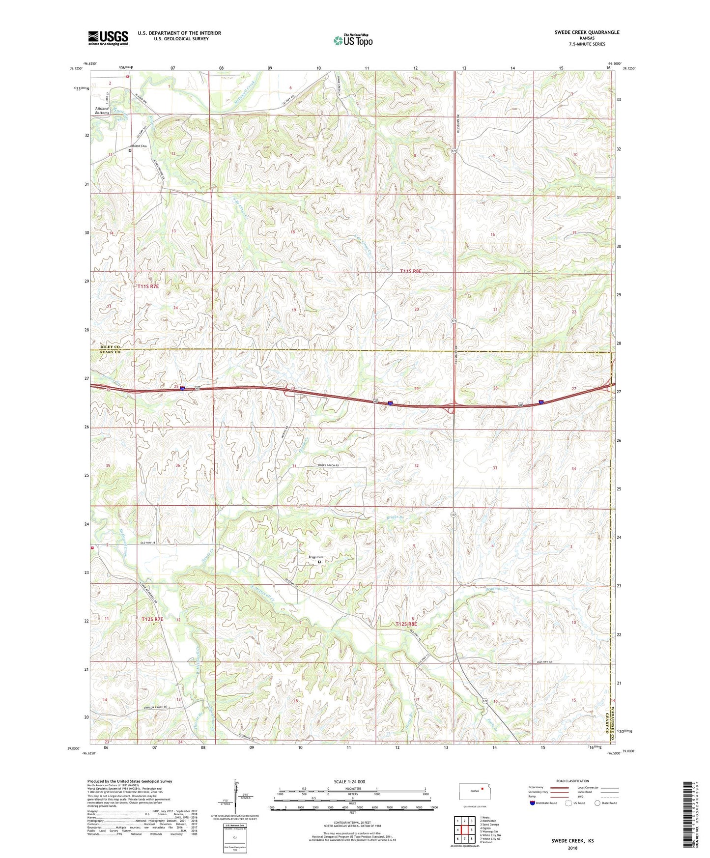
2022 topographic map quadrangle Swede Creek in the state of Kansas. Scale: 1:24000. Based on the newly updated USGS 7.5' US Topo map series, this map is in the following counties: Geary, Riley, Wabaunsee. The map contains contour data, water features, and other items you are used to seeing on USGS maps, but also has updated roads and other features. This is the next generation of topographic maps. Printed on high-quality waterproof paper with UV fade-resistant inks.
Quads adjacent to this one:
West: Ogden
Northwest: Keats
North: Manhattan
Northeast: Saint George
East: Wamego SW
Southeast: Volland
South: White City NE
Southwest: White City NW
This map covers the same area as the classic USGS quad with code o39096a5.
Contains the following named places: Ashland, Ashland Cemetery, Briggs, Briggs Branch, Briggs Cemetery, Briggs School, Cleveland School, Deadman Creek, East McDowell Creek, Geary County Rural Fire Department Station 7, Horne Branch, Jewell County Lake, Kansas Department of Transportation Geary County Rest Area Interstate 70 East, Kansas Department of Transportation Geary County Rest Area Interstate 70 West, Kings Creek, Konza Prairie Natural Area, MacArthur Branch, McDowell Creek School, North Branch, North Branch Kings Creek, Poole Branch, Riley County Fire District 1 Station 2, School Number 4, South Branch, South Branch Kings Creek, Swede Creek, Thierer Branch, Township of Ashland, Township of Jackson, West McDowell Creek