MyTopo
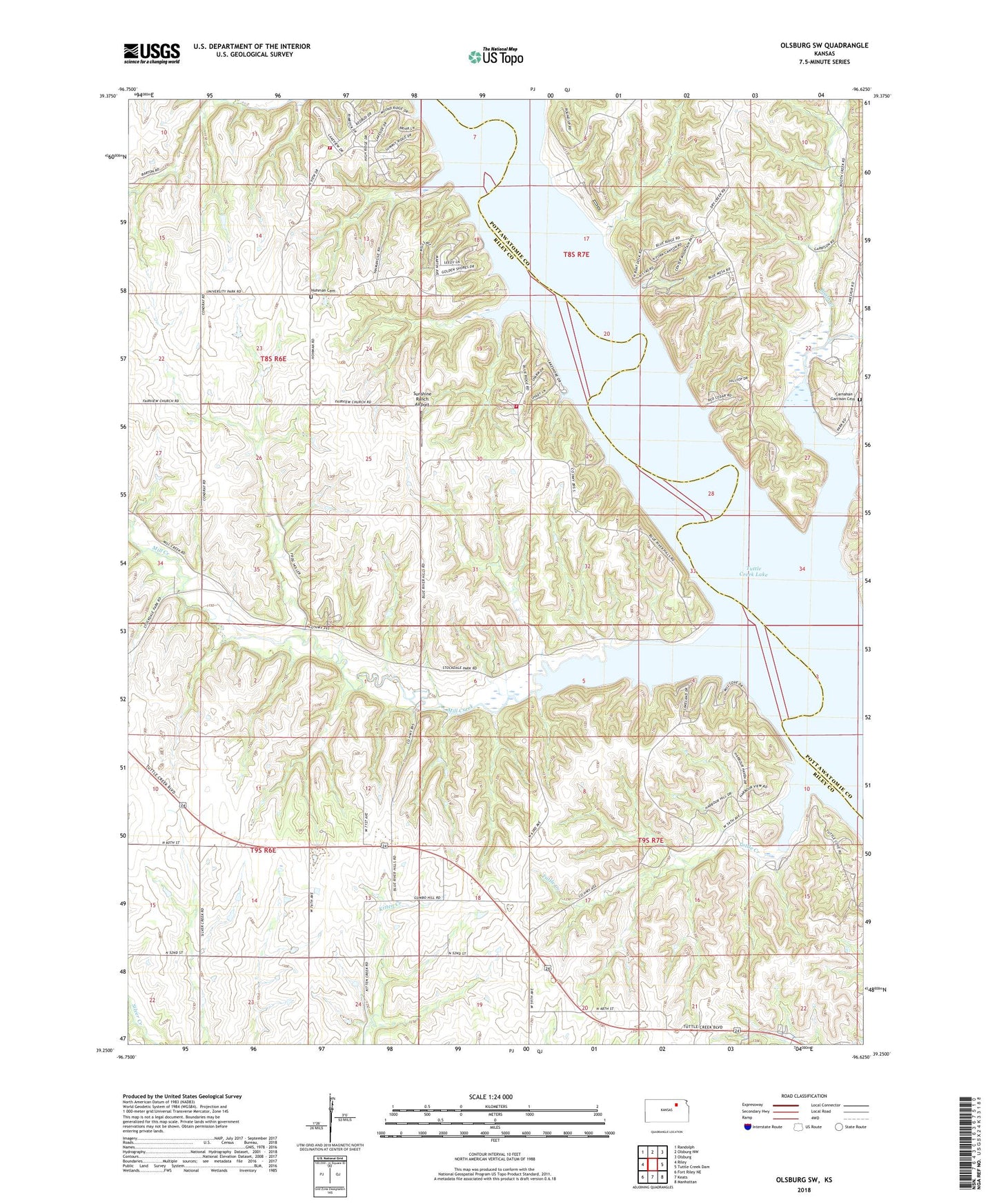
Olsburg SW Kansas US Topo Map
Couldn't load pickup availability
2022 topographic map quadrangle Olsburg SW in the state of Kansas. Scale: 1:24000. Based on the newly updated USGS 7.5' US Topo map series, this map is in the following counties: Riley, Pottawatomie. The map contains contour data, water features, and other items you are used to seeing on USGS maps, but also has updated roads and other features. This is the next generation of topographic maps. Printed on high-quality waterproof paper with UV fade-resistant inks.
Quads adjacent to this one:
West: Riley
Northwest: Randolph
North: Olsburg NW
Northeast: Olsburg
East: Tuttle Creek Dam
Southeast: Manhattan
South: Keats
Southwest: Fort Riley NE
This map covers the same area as the classic USGS quad with code o39096c6.
Contains the following named places: Booth Creek, Carnahan - Garrison Cemetery, Carnahan Church, Carnahan Creek, Carnahan Creek Recreation Area, Dry Creek, Garrison Recreation Area, Hohman Cemetery, Mill Creek, Riley County, Riley County Fire District 1 Station 10, Riley County Fire District 1 Station 11, Sedalia Community Church, Stockdale, Stockdale Recreation Area, Sunshine Ranch Airport, Terra Heights Wastewater Treatment Plant, Township of Grant, Tuttle Creek, Tuttle Creek Lake, ZIP Code: 66503