MyTopo
Osawatomie Kansas US Topo Map
Couldn't load pickup availability
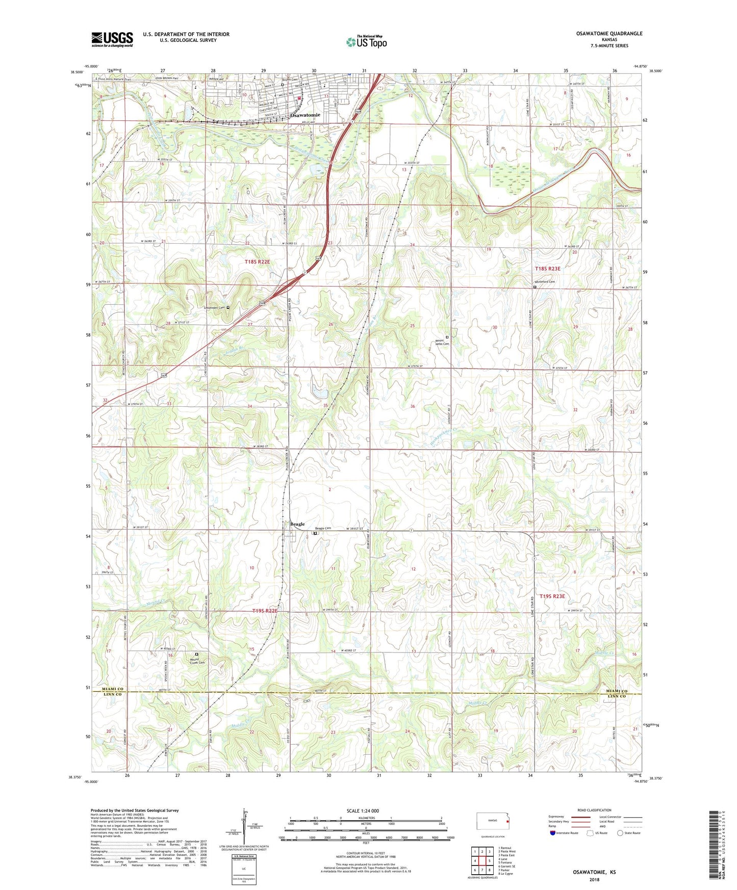
2022 topographic map quadrangle Osawatomie in the state of Kansas. Scale: 1:24000. Based on the newly updated USGS 7.5' US Topo map series, this map is in the following counties: Miami, Linn. The map contains contour data, water features, and other items you are used to seeing on USGS maps, but also has updated roads and other features. This is the next generation of topographic maps. Printed on high-quality waterproof paper with UV fade-resistant inks.
Quads adjacent to this one:
West: Lane
Northwest: Rantoul
North: Paola West
Northeast: Paola East
East: Fontana
Southeast: La Cygne
South: Parker
Southwest: Garnett SE
This map covers the same area as the classic USGS quad with code o38094d8.
Contains the following named places: Bangor, Beagle, Beagle Cemetery, Beagle United Methodist Church, Brown Cemetery, Church of Christ, Community of Christ, East Upper Elementary School, Faith Baptist Church, First Baptist Church, First Christian Church, First Presbyterian Church, First United Methodist Church, John Brown Museum, Jordan Branch, Lessenden Cemetery, Memorial Hall, Mound Creek, Mound Creek Cemetery, Mount Nebo Cemetery, Osage Valley School, Osawatomie, Osawatomie Chamber of Commerce, Osawatomie Church of the Nazarene, Osawatomie City Auditorium, Osawatomie City Hall, Osawatomie High School, Osawatomie Middle School, Osawatomie Post Office, Osawatomie Public Library, Osawatomie Railroad Museum, Osawatomie Southern Baptist Church, Osawatomie Unified School District Office, Osawatomie Volunteer Fire Department, Plum Creek Road Church of Christ, Pottawatomie Creek, Swenson Early Education Center, Township of Mound, Township of Osawatomie, Trojan Elementary School, Union Valley School, Whiteford Cemetery, ZIP Code: 66064