MyTopo
Fontana Kansas US Topo Map
Couldn't load pickup availability
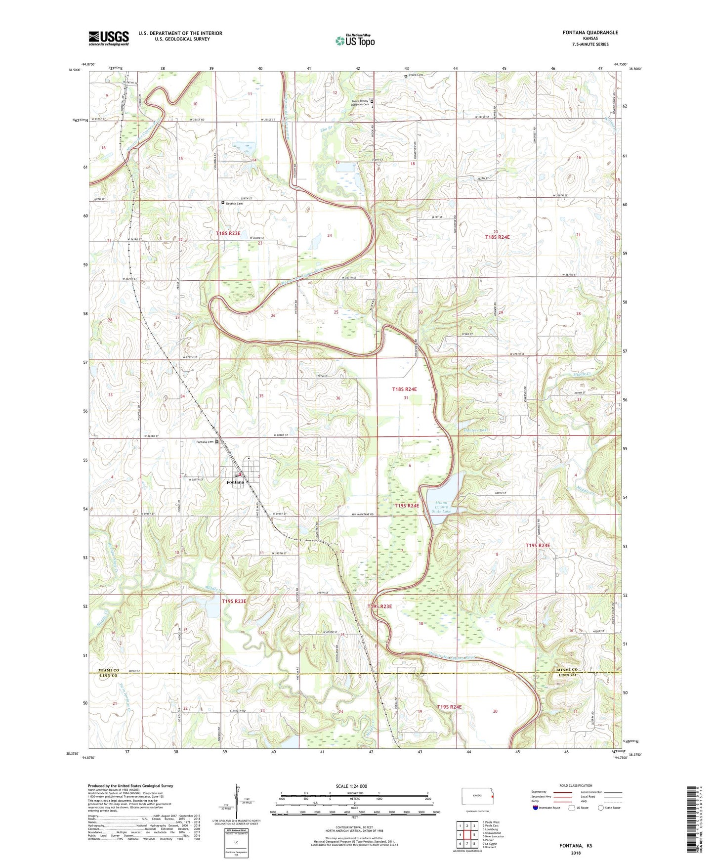
2022 topographic map quadrangle Fontana in the state of Kansas. Scale: 1:24000. Based on the newly updated USGS 7.5' US Topo map series, this map is in the following counties: Miami, Linn. The map contains contour data, water features, and other items you are used to seeing on USGS maps, but also has updated roads and other features. This is the next generation of topographic maps. Printed on high-quality waterproof paper with UV fade-resistant inks.
Quads adjacent to this one:
West: Osawatomie
Northwest: Paola West
North: Paola East
Northeast: Louisburg
East: New Lancaster
Southeast: Boicourt
South: La Cygne
Southwest: Parker
This map covers the same area as the classic USGS quad with code o38094d7.
Contains the following named places: Beachner Grain Elevator Number 19, Block Trinity Lutheran Cemetery, City of Fontana, Debrick Cemetery, Elm Branch, Fontana, Fontana Cemetery, Fontana Christian Church, Fontana Church of Christ, Fontana City Hall, Fontana Elementary School, Fontana Post Office, Fontana United Methodist Church, Fontana Wastewater Plant, Hawkeye School, Hunters Lake, Hushpuckney Creek, Miami County Rural Fire District 1, Miami County State Lake, Miami County State Lake Dam, Miami County State Park, Miami State Fishing Lake and Wildlife Area, Township of Osage, Trinity Lutheran Church, Trinity Lutheran School, ZIP Code: 66026