MyTopo
La Cygne Kansas US Topo Map
Couldn't load pickup availability
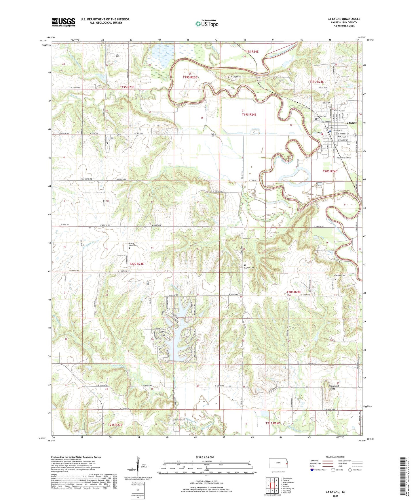
2022 topographic map quadrangle La Cygne in the state of Kansas. Scale: 1:24000. Based on the newly updated USGS 7.5' US Topo map series, this map is in the following counties: Linn. The map contains contour data, water features, and other items you are used to seeing on USGS maps, but also has updated roads and other features. This is the next generation of topographic maps. Printed on high-quality waterproof paper with UV fade-resistant inks.
Quads adjacent to this one:
West: Parker
Northwest: Osawatomie
North: Fontana
Northeast: New Lancaster
East: Boicourt
Southeast: Pleasanton
South: Mound City
Southwest: Mound City NW
This map covers the same area as the classic USGS quad with code o38094c7.
Contains the following named places: Beachner Grain Elevator Number 24, Brooklyn Cemetery, Brooklyn School, Calvary Baptist Church, City of La Cygne, Elm Creek, Emergystat Ambulance of Linn County, Graveyard Mound, Hickory Creek, Hurley Field, La Cygne, La Cygne Christian Church, La Cygne City Hall, La Cygne Community Building, La Cygne Historical Society Museum, La Cygne Police Department, La Cygne Post Office, La Cygne Senior Center, La Cygne Sewer Treatment Plant, La Cygne United Methodist Church, La Cygne Volunteer Fire Department, La Cygne Water Treatment Plant, LaCygne Elementary School, Lacygne Industrial Park, Linn County Library District Number 2, Middle Creek, Oak Grove School, Oaklawn Cemetery, Our Lady of the Lourdes Catholic Church, Prairie Home Cemetery, Prairie Home School, Prairie View High School, Prairie View High School Police United School District 362, Prairie View Middle School, Richland Cemetery, Richland Creek, Riverview Cemetery, Stave Lake, Tanglewood Lakes Wastewater Treatment Plant, Township of Scott, Turkey Creek, Twin Springs Church, Twin Springs Creek