MyTopo
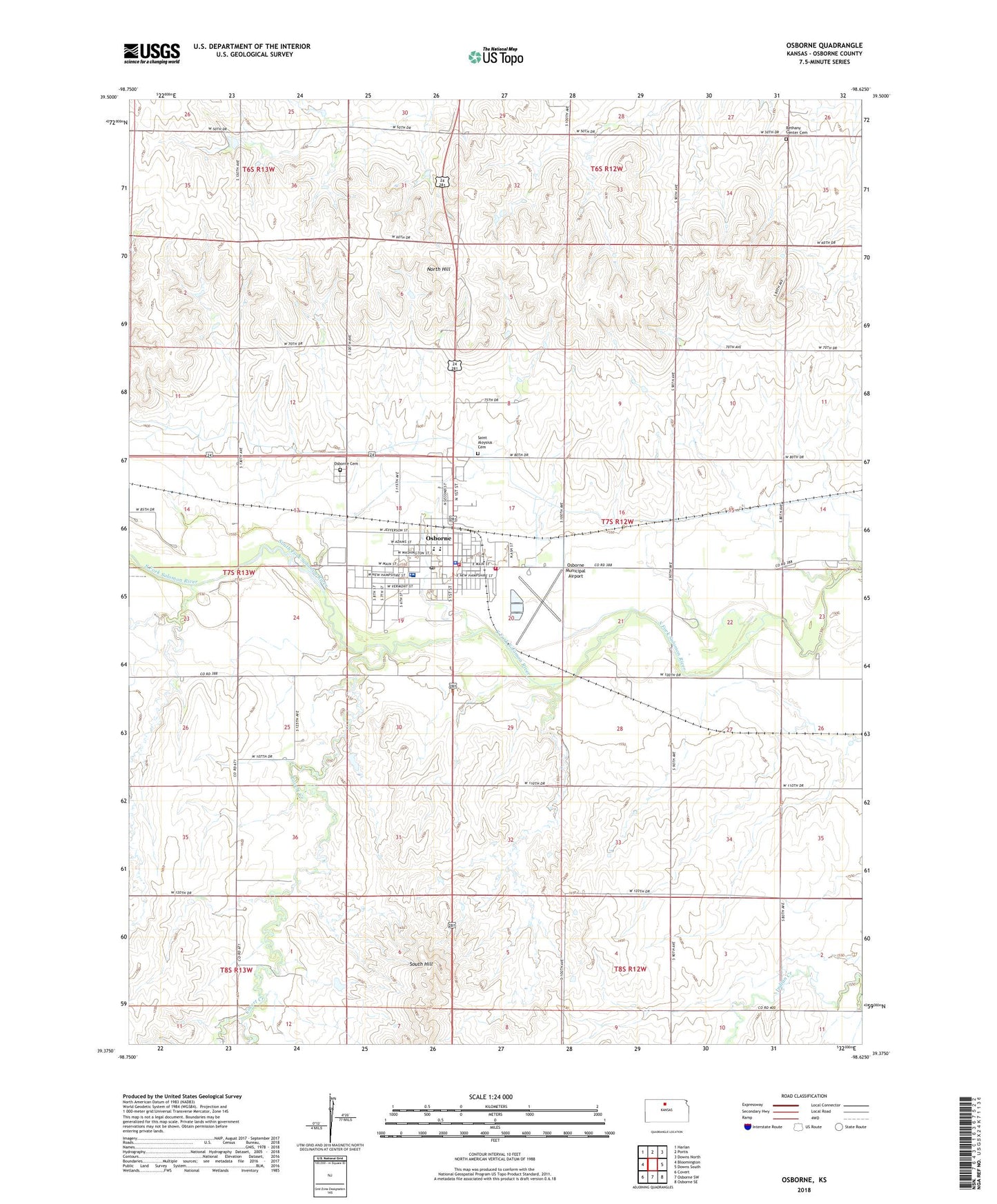
Osborne Kansas US Topo Map
Couldn't load pickup availability
2022 topographic map quadrangle Osborne in the state of Kansas. Scale: 1:24000. Based on the newly updated USGS 7.5' US Topo map series, this map is in the following counties: Osborne. The map contains contour data, water features, and other items you are used to seeing on USGS maps, but also has updated roads and other features. This is the next generation of topographic maps. Printed on high-quality waterproof paper with UV fade-resistant inks.
Quads adjacent to this one:
West: Bloomington
Northwest: Harlan
North: Portis
Northeast: Downs North
East: Downs South
Southeast: Osborne SE
South: Osborne SW
Southwest: Covert
This map covers the same area as the classic USGS quad with code o39098d6.
Contains the following named places: Assembly of God Church, Bethany Center Cemetery, Bible Baptist Church, City of Osborne, Covert Creek, Faith Lutheran Church, Midway Co - Operative Association Grain Elevator Number 1, Midway Co - Operative Association Grain Elevator Number 9, Mount Hope School, North Hill, Osborne, Osborne Cemetery, Osborne City Hall, Osborne Country Club, Osborne County Courthouse, Osborne County Emergency Medical Services, Osborne County Fairgrounds, Osborne County Health Department, Osborne County Historical Museum, Osborne County Jail, Osborne County Memorial Hospital, Osborne County Sheriff's Office, Osborne Diversion Dam, Osborne Elementary School, Osborne Fire Department, Osborne Free Methodist Church, Osborne Junior / Senior High School, Osborne Municipal Airport, Osborne Police Department, Osborne Post Office, Osborne Public Library, Osborne Rural Fire Department Station 1, Osborne Sewer Treatment Plant, Osborne Speedway, Osborne United Methodist Church, Saint Aloysius Cemetery, Saint Aloysius Gonzaga Catholic Church, Shady Bend Golf Course, South Hill, Township of Penn, United Christian Church, United Christian Church Rock Solid Ministries, ZIP Code: 67473