MyTopo
Portis Kansas US Topo Map
Couldn't load pickup availability
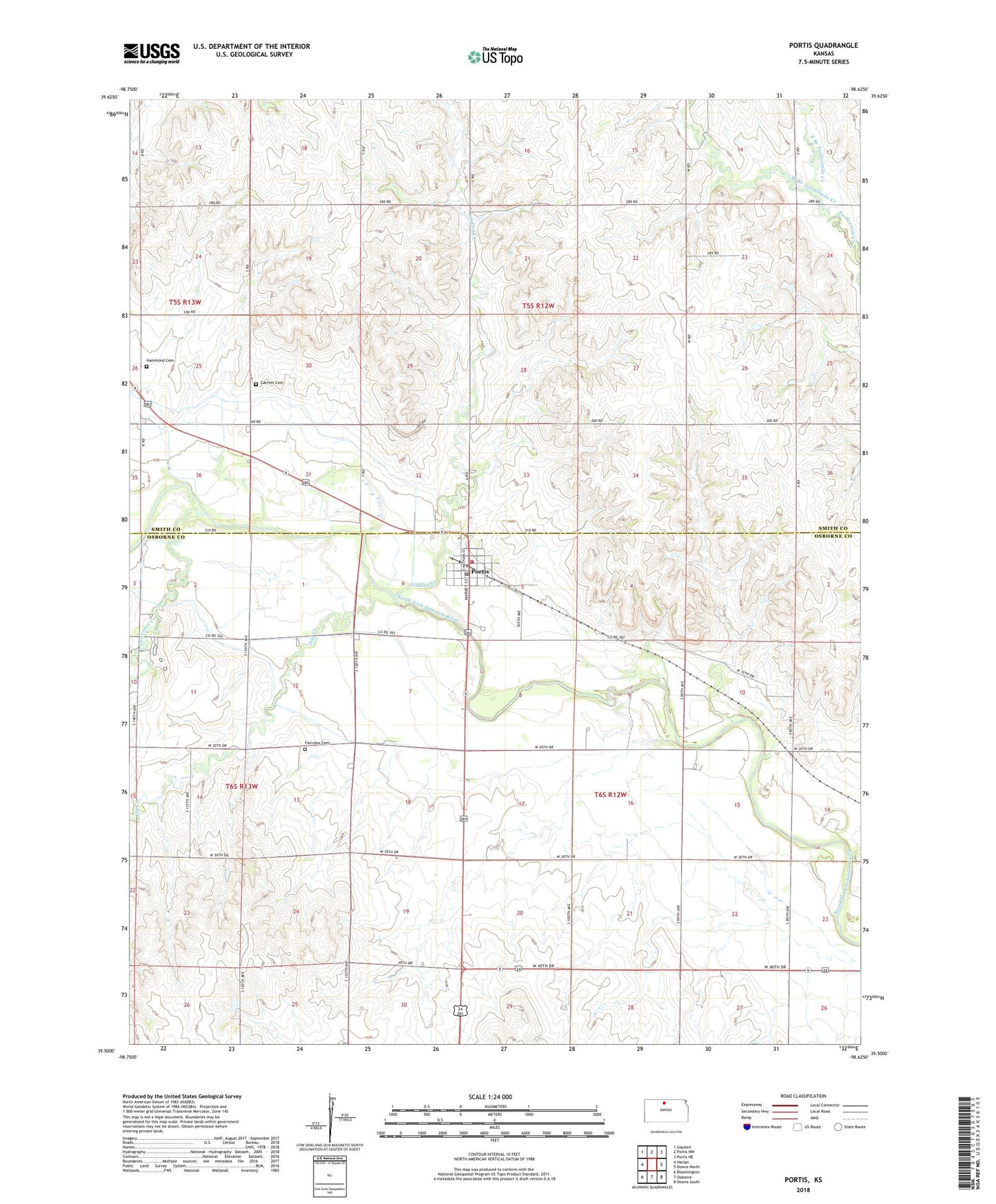
2022 topographic map quadrangle Portis in the state of Kansas. Scale: 1:24000. Based on the newly updated USGS 7.5' US Topo map series, this map is in the following counties: Smith, Osborne. The map contains contour data, water features, and other items you are used to seeing on USGS maps, but also has updated roads and other features. This is the next generation of topographic maps. Printed on high-quality waterproof paper with UV fade-resistant inks.
Quads adjacent to this one:
West: Harlan
Northwest: Gaylord
North: Portis NW
Northeast: Portis NE
East: Downs North
Southeast: Downs South
South: Osborne
Southwest: Bloomington
This map covers the same area as the classic USGS quad with code o39098e6.
Contains the following named places: City of Portis, East Branch Twelvemile Creek, Fairview Cemetery, Garrett Cemetery, Grace Brethren Church of Portis, Hammond Cemetery, Joy Creek, Lawrence Creek, Lindley Creek, Midway Co - Operative Association Grain Elevator Number 11, Osborne Rural Fire Department Station 2, Portis, Portis Post Office, Township of Bethany, Township of Garfield, Twelve Mile, West Branch Twelvemile Creek, ZIP Code: 67474