MyTopo
Downs North Kansas US Topo Map
Couldn't load pickup availability
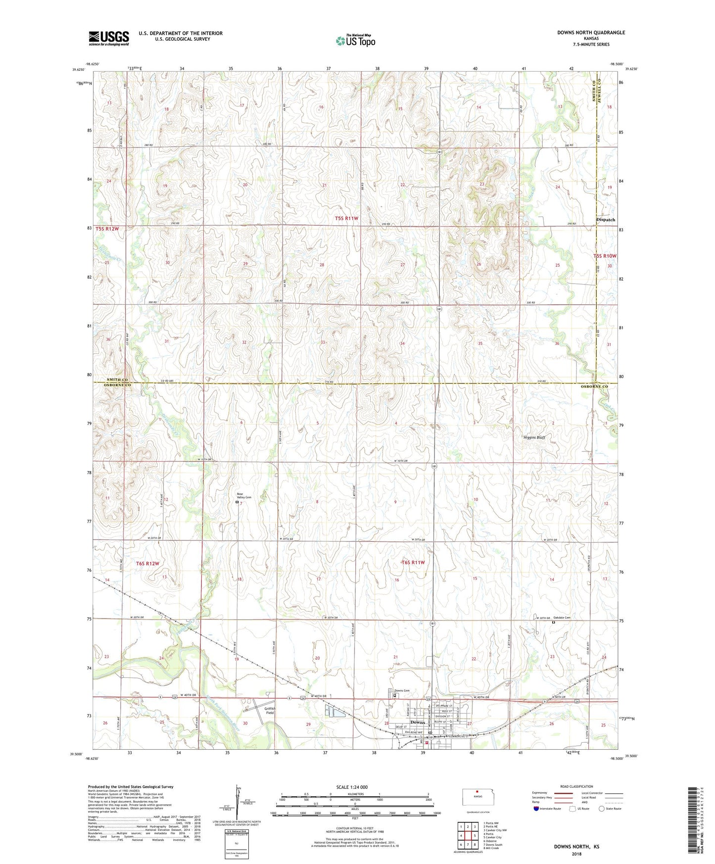
2022 topographic map quadrangle Downs North in the state of Kansas. Scale: 1:24000. Based on the newly updated USGS 7.5' US Topo map series, this map is in the following counties: Smith, Osborne, Jewell. The map contains contour data, water features, and other items you are used to seeing on USGS maps, but also has updated roads and other features. This is the next generation of topographic maps. Printed on high-quality waterproof paper with UV fade-resistant inks.
Quads adjacent to this one:
West: Portis
Northwest: Portis NW
North: Portis NE
Northeast: Cawker City NW
East: Cawker City
Southeast: Mill Creek
South: Downs South
Southwest: Osborne
This map covers the same area as the classic USGS quad with code o39098e5.
Contains the following named places: City of Downs, Dispatch, Dispatch Christian Reformed Church, Downs Carnegie Library, Downs Cemetery, Downs City Hall, Downs Fire Department, Downs Golf Course, Downs High School, Downs Post Office, Downs Seventh Day Adventist Church, Downs United Methodist Church, First Christian Church, Griffith Field, Higgins Bluff, Lakeside Elementary School - Downs, Lakeside High School, Lighthouse Community Church, Midway Co - Operative Association Grain Elevator Number 7, Oak Creek School, Oakdale Cemetery, Orange, Pleasant Ridge School, Rose Valley Cemetery, Rose Valley United Methodist Church, Saint Mary's Catholic Church, Scoular Company Grain Elevator Number 3, Township of Lincoln, Township of Ross, Twelvemile Creek, Twelvemile School, Zion Lutheran Church, ZIP Code: 67437