MyTopo
Piqua Kansas US Topo Map
Couldn't load pickup availability
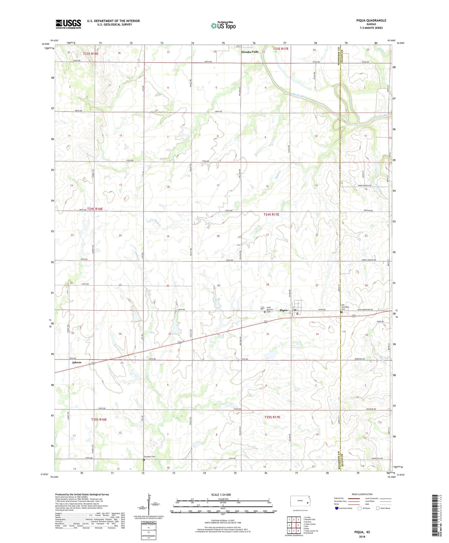
2022 topographic map quadrangle Piqua in the state of Kansas. Scale: 1:24000. Based on the newly updated USGS 7.5' US Topo map series, this map is in the following counties: Woodson, Allen. The map contains contour data, water features, and other items you are used to seeing on USGS maps, but also has updated roads and other features. This is the next generation of topographic maps. Printed on high-quality waterproof paper with UV fade-resistant inks.
Quads adjacent to this one:
West: Yates Center
Northwest: Le Roy
North: Neosho Falls
Northeast: Geneva
East: Iola
Southeast: Humboldt
South: Yates Center SE
Southwest: Rose
This map covers the same area as the classic USGS quad with code o37095h5.
Contains the following named places: Athens, Clay Bank School, Enterprise School, Indian Creek, Iola Township Cemetery, McClannahan School, Newton School, Piqua, Piqua Census Designated Place, Piqua Farmers Co - Operative Association Grain Elevator Number 1, Piqua Fire Department, Piqua Post Office, Pleasant Valley School, Plum Creek School, Rock Creek, Saint Martin's Catholic Church, Saint Martin's Cemetery, Saint Martins School, Schaede Cemetery, Spawr School, Township of Neosho Falls, Vernon Oil Field, West Liberty School, Woodson County Improvement District, ZIP Code: 66761