MyTopo
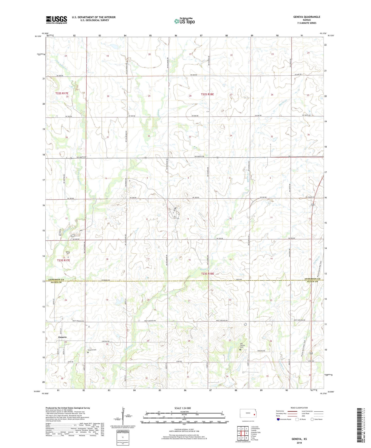
Geneva Kansas US Topo Map
Couldn't load pickup availability
2022 topographic map quadrangle Geneva in the state of Kansas. Scale: 1:24000. Based on the newly updated USGS 7.5' US Topo map series, this map is in the following counties: Anderson, Allen. The map contains contour data, water features, and other items you are used to seeing on USGS maps, but also has updated roads and other features. This is the next generation of topographic maps. Printed on high-quality waterproof paper with UV fade-resistant inks.
Quads adjacent to this one:
West: Neosho Falls
Northwest: Aliceville
North: Westphalia
Northeast: Welda
East: Colony
Southeast: La Harpe
South: Iola
Southwest: Piqua
This map covers the same area as the classic USGS quad with code o38095a4.
Contains the following named places: Como, Crystal Lake, Geneva, Geneva Cemetery, Little Indian Creek, Northcott, Northcott Christian Church, Old Carlyle Cemetery, Old Carlyle School, Township of Indian Creek, ZIP Code: 66015