MyTopo
Yates Center SE Kansas US Topo Map
Couldn't load pickup availability
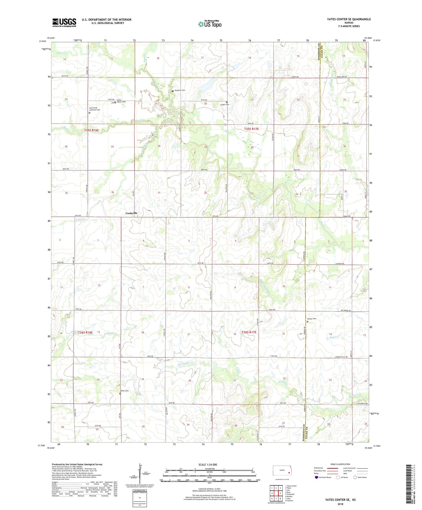
2022 topographic map quadrangle Yates Center SE in the state of Kansas. Scale: 1:24000. Based on the newly updated USGS 7.5' US Topo map series, this map is in the following counties: Woodson, Allen. The map contains contour data, water features, and other items you are used to seeing on USGS maps, but also has updated roads and other features. This is the next generation of topographic maps. Printed on high-quality waterproof paper with UV fade-resistant inks.
Quads adjacent to this one:
West: Rose
Northwest: Yates Center
North: Piqua
Northeast: Iola
East: Humboldt
Southeast: Chanute
South: Vilas
Southwest: Buffalo
This map covers the same area as the classic USGS quad with code o37095g5.
Contains the following named places: Center Ridge School, Cherry Creek, Cherry Creek School, Cookville, Ellison Cemetery, Hopewell School, Linder Cemetery, Maple Grove Church, Mound Valley School, Oliver Cemetery, Otter Springs Creek, Otter Springs School, Owl Creek Lutheran Cemetery, Owl Creek School, Plum Creek, Prairie Center School, Prairie Flower School, Ridgeway, Rose Oil Field, Saint Marys Cemetery, Skeeters Cemetery, South Maple Grove School, South Owl Creek, Township of Owl Creek, Township of Perry