MyTopo
Fairview Kansas US Topo Map
Couldn't load pickup availability
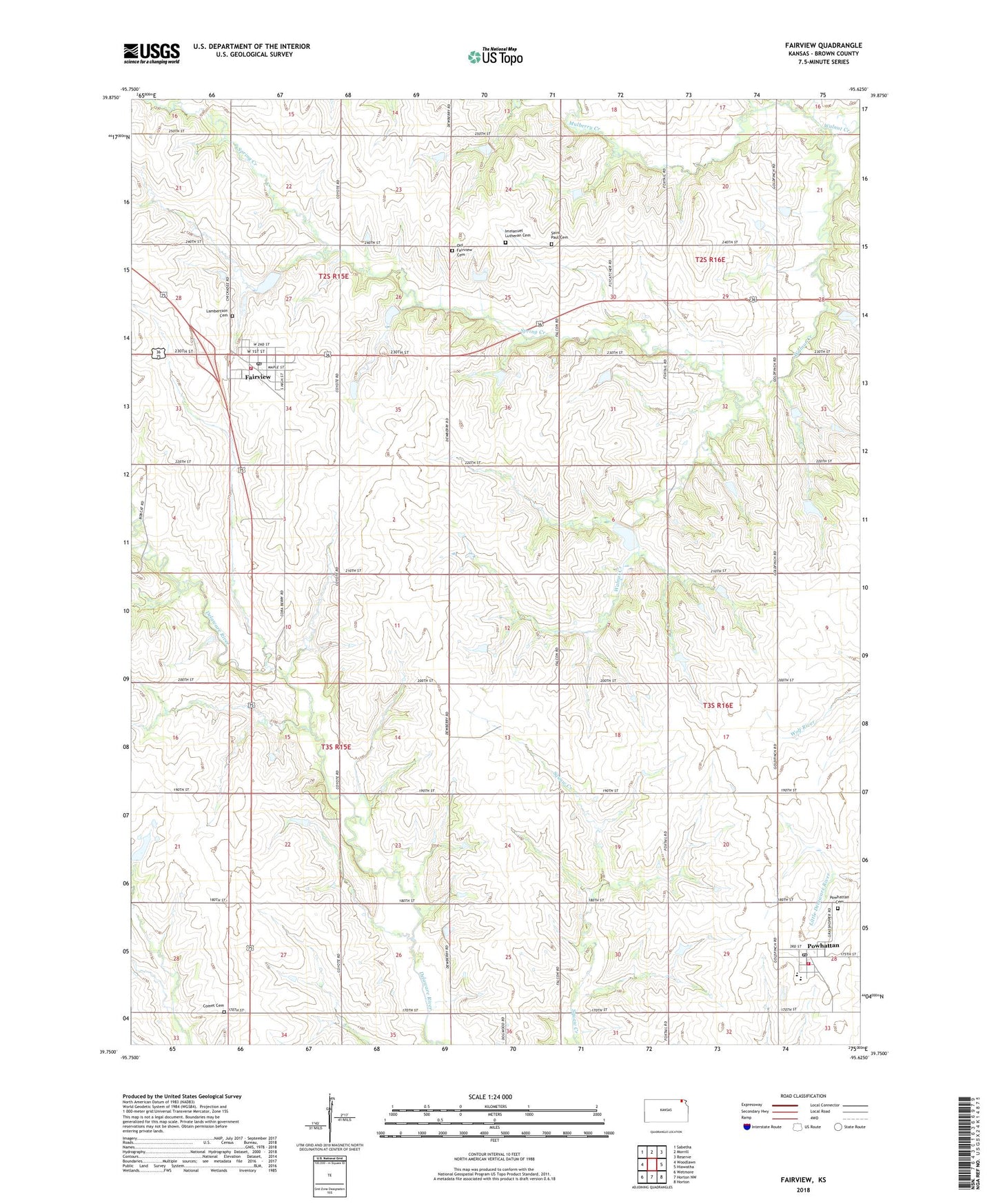
2023 topographic map quadrangle Fairview in the state of Kansas. Scale: 1:24000. Based on the newly updated USGS 7.5' US Topo map series, this map is in the following counties: Brown. The map contains contour data, water features, and other items you are used to seeing on USGS maps, but also has updated roads and other features. This is the next generation of topographic maps. Printed on high-quality waterproof paper with UV fade-resistant inks.
Quads adjacent to this one:
West: Woodlawn
Northwest: Sabetha
North: Morrill
Northeast: Reserve
East: Hiawatha
Southeast: Horton
South: Horton NW
Southwest: Wetmore
This map covers the same area as the classic USGS quad with code o39095g6.
Contains the following named places: Agricultural Partners Co - Operative Grain Elevator Number 5, American Church, Carson, City of Fairview, City of Powhattan, Cleo, Comet, Comet Cemetery, Croxton Airport, Delaware Baptist Church, Fairview, Fairview - Walnut Volunteer Fire Department, Fairview Post Office, Fairview United Church of Christ, Fairview Wastewater Treatment Facility, Fairway Shops, Grand Prairie, Immanuel Lutheran Cemetery, Immanuel Lutheran Church, Kickapoo Nation High School, Kickapoo Nation School, Lambertson Cemetery, Mulberry Creek, Old Fairview Cemetery, Plum Creek, Powhattan, Powhattan Cemetery, Powhattan Fire Department, Powhattan Post Office, Powhattan United Methodist Church, Powhattan Wastewater Plant, Saint Paul Cemetery, Saint Paul Lutheran Church, Spring Creek, Township of Walnut, ZIP Code: 66425