MyTopo
Saint George Kansas US Topo Map
Couldn't load pickup availability
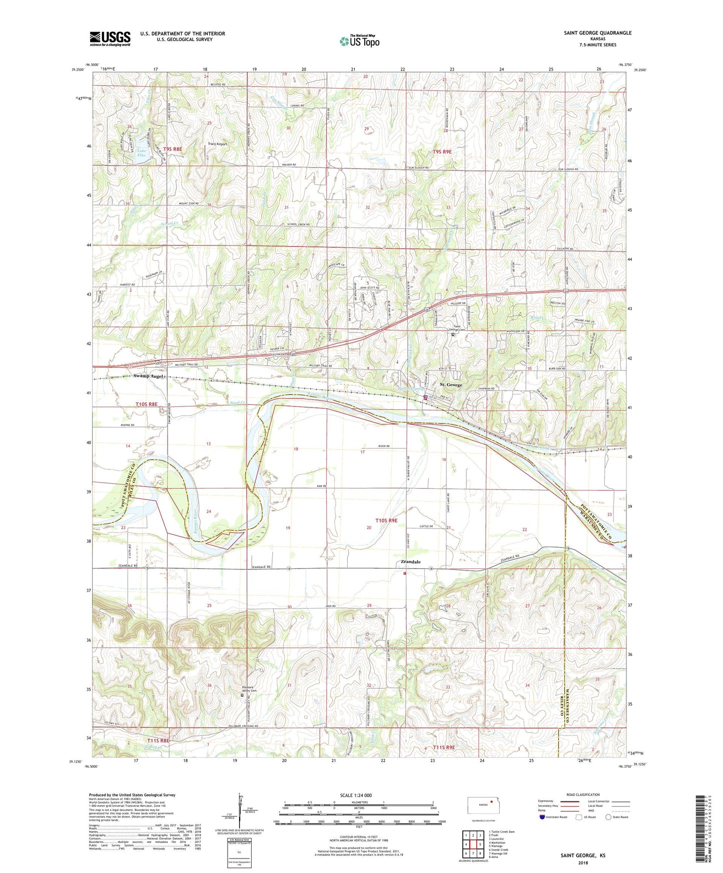
2022 topographic map quadrangle Saint George in the state of Kansas. Scale: 1:24000. Based on the newly updated USGS 7.5' US Topo map series, this map is in the following counties: Pottawatomie, Riley, Wabaunsee. The map contains contour data, water features, and other items you are used to seeing on USGS maps, but also has updated roads and other features. This is the next generation of topographic maps. Printed on high-quality waterproof paper with UV fade-resistant inks.
Quads adjacent to this one:
West: Manhattan
Northwest: Tuttle Creek Dam
North: Flush
Northeast: Louisville
East: Wamego
Southeast: Alma
South: Wamego SW
Southwest: Swede Creek
This map covers the same area as the classic USGS quad with code o39096b4.
Contains the following named places: Blackjack Creek, Blackjack Spring, Blood Creek, City of Saint George, Eldon, Emmons Creek, In the Field Mobile Home Park, Lake Elbo, Mount Zion Church, Pillsbury Crossing, Pleasant Valley Cemetery, Plum Creek, Pottawatomie County Fire District 10 Saint George, Riley County Fire District 1 Station 1, Saint George, Saint George Cemetery, Saint George Elementary School, Saint George High School, Saint George Mobile Home Park, Saint George Police Department, Saint George Post Office, Saint George United Methodist Church, Saint George Wastewater Treatment Plant, Sand Creek, School Creek, Sunflower School, Swamp Angel, Township of Saint George, Tracy Airport, Walnut Grove Mobile Home Park, Zeandale, Zeandale Census Designated Place, Zeandale Community Church