MyTopo
Speed Kansas US Topo Map
Couldn't load pickup availability
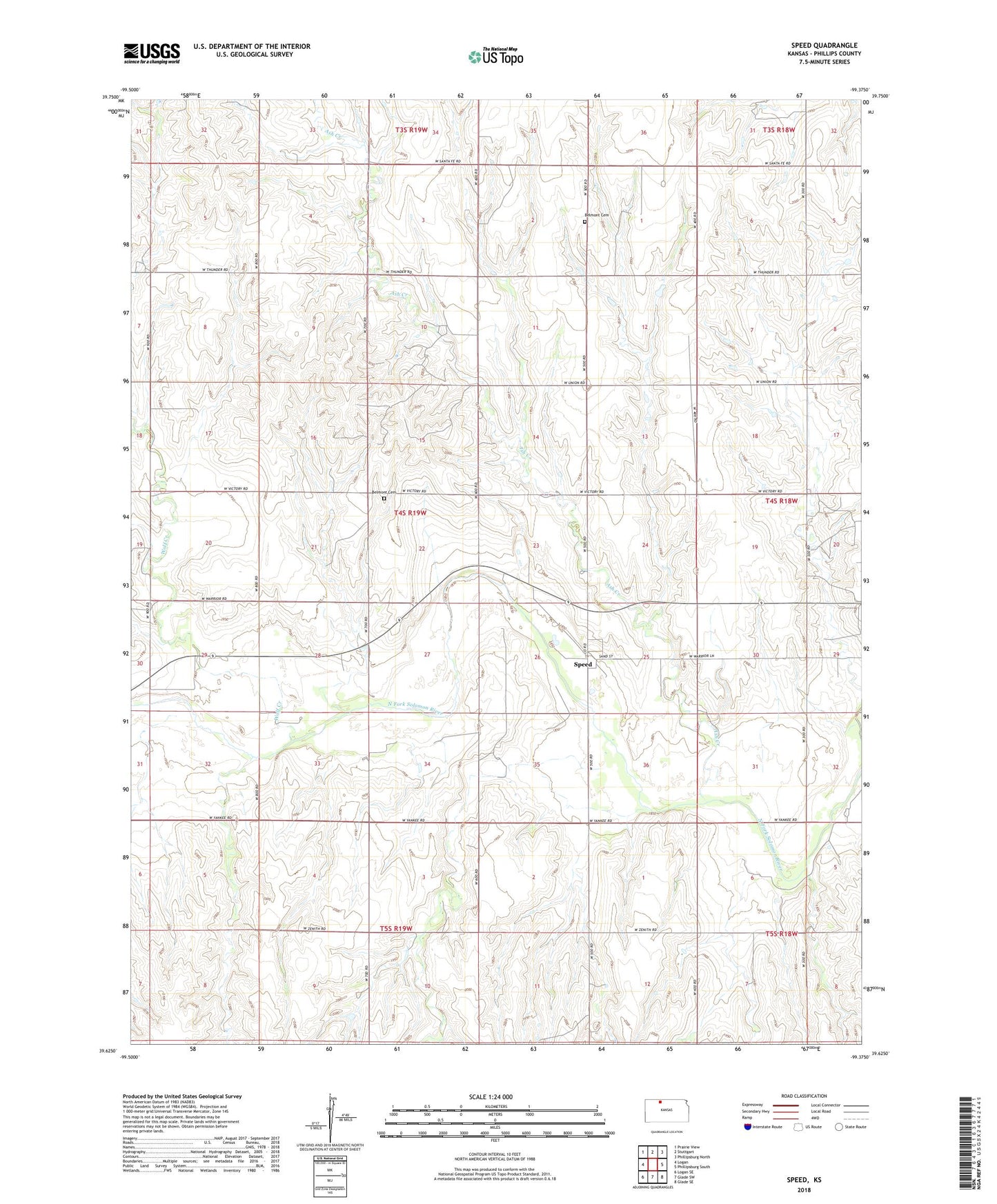
2022 topographic map quadrangle Speed in the state of Kansas. Scale: 1:24000. Based on the newly updated USGS 7.5' US Topo map series, this map is in the following counties: Phillips. The map contains contour data, water features, and other items you are used to seeing on USGS maps, but also has updated roads and other features. This is the next generation of topographic maps. Printed on high-quality waterproof paper with UV fade-resistant inks.
Quads adjacent to this one:
West: Logan
Northwest: Prairie View
North: Stuttgart
Northeast: Phillipsburg North
East: Phillipsburg South
Southeast: Glade SE
South: Glade SW
Southwest: Logan SE
This map covers the same area as the classic USGS quad with code o39099f4.
Contains the following named places: Ash Creek, Belmont Cemetery, City of Speed, Emmanuel Evangelical Lutheran Church, Rangeland Co - Operative Grain Elevator Number 5, Speed, Township of Belmont, Wolf Creek