MyTopo
Stuttgart Kansas US Topo Map
Couldn't load pickup availability
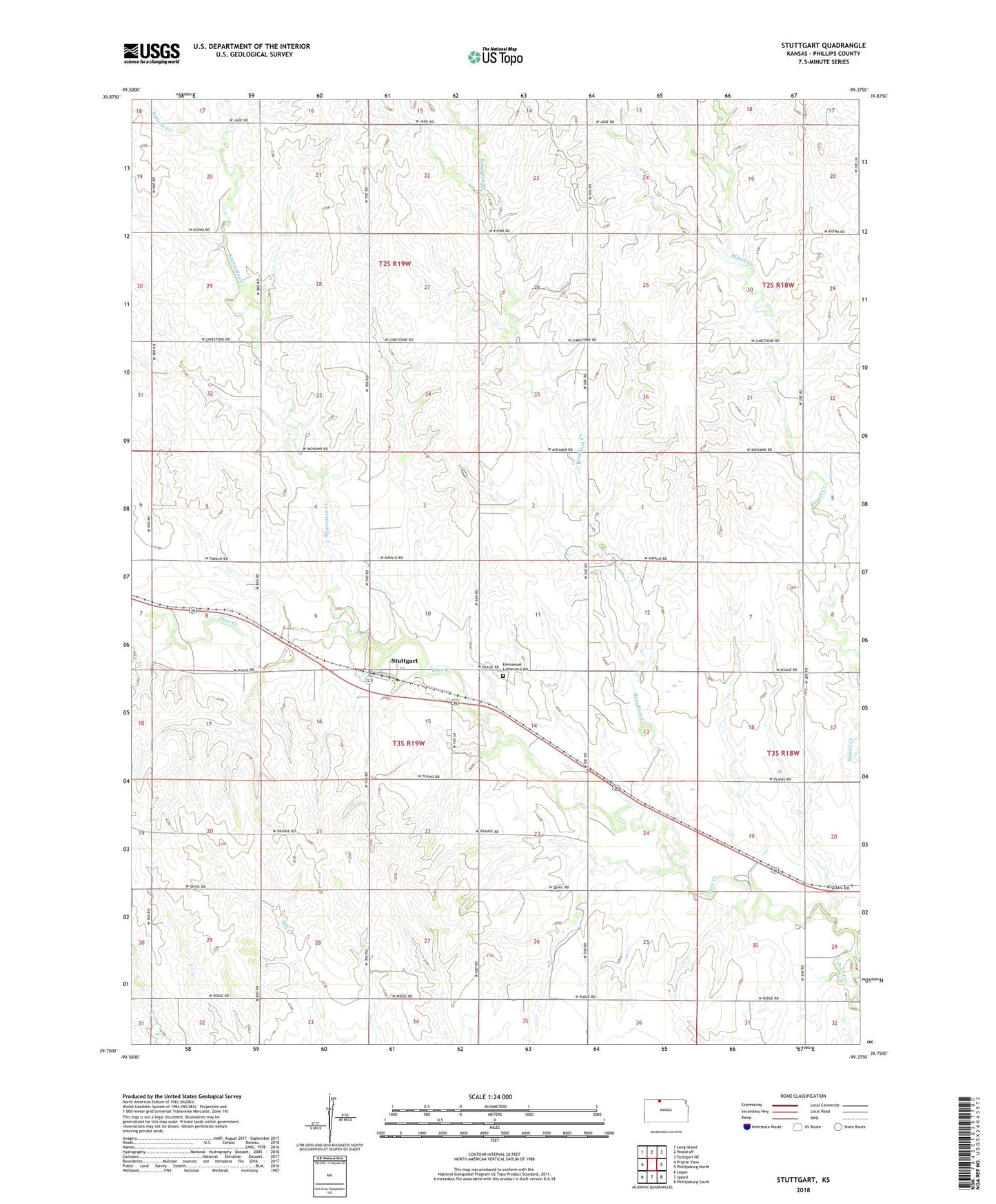
2022 topographic map quadrangle Stuttgart in the state of Kansas. Scale: 1:24000. Based on the newly updated USGS 7.5' US Topo map series, this map is in the following counties: Phillips. The map contains contour data, water features, and other items you are used to seeing on USGS maps, but also has updated roads and other features. This is the next generation of topographic maps. Printed on high-quality waterproof paper with UV fade-resistant inks.
Quads adjacent to this one:
West: Prairie View
Northwest: Long Island
North: Woodruff
Northeast: Stuttgart NE
East: Phillipsburg North
Southeast: Phillipsburg South
South: Speed
Southwest: Logan
This map covers the same area as the classic USGS quad with code o39099g4.
Contains the following named places: Bissell Creek, Boughton Creek, Dickeyville, Emmanuel Lutheran Cemetery, Hanson Creek, Hi-Plains Co - Operative Association Grain Elevator Number 8, Starvation Creek, Stuttgart, Stuttgart Census Designated Place, Township of Dayton, Township of Mound, Wagnerville