MyTopo
Beaver Kansas US Topo Map
Couldn't load pickup availability
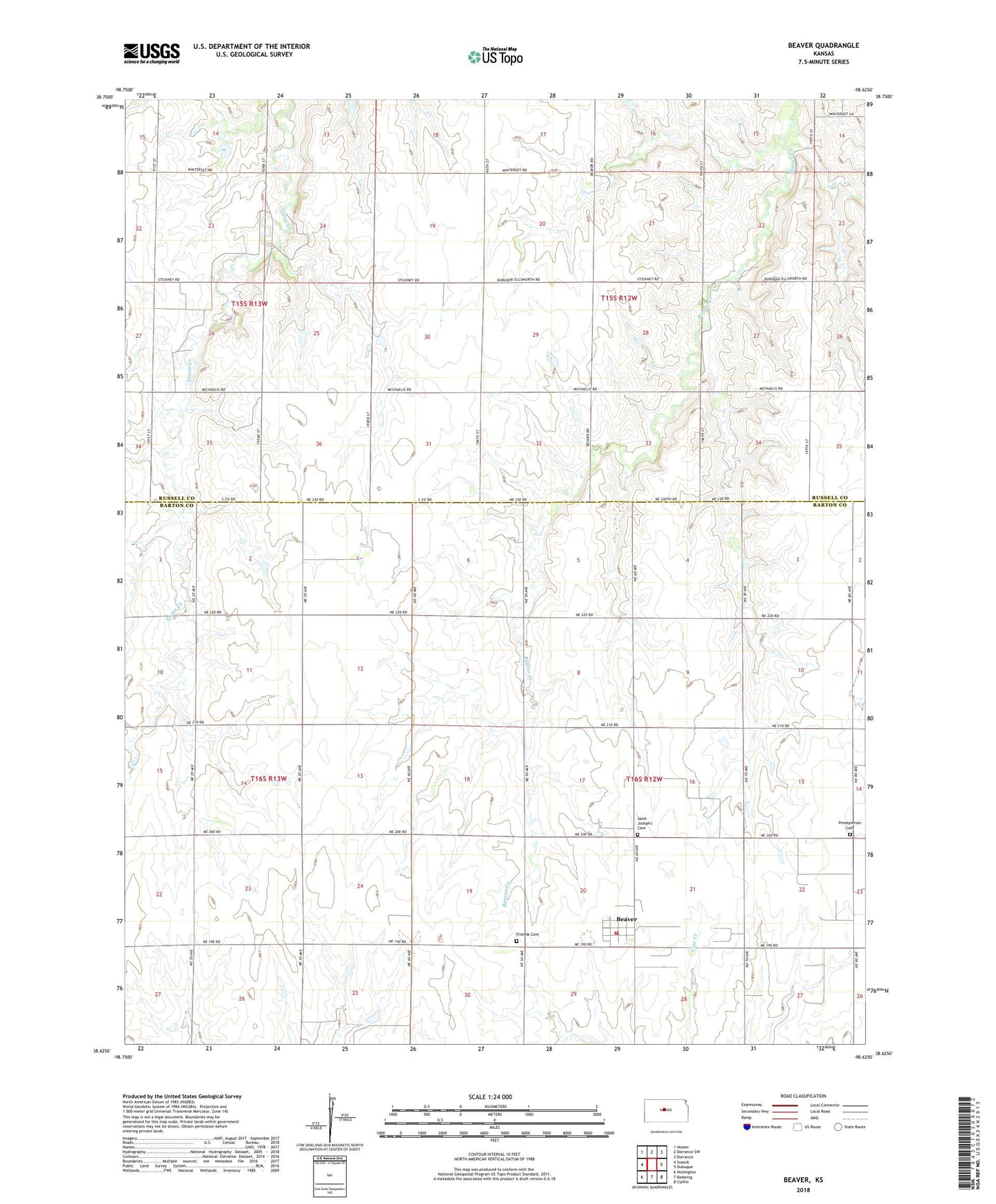
2022 topographic map quadrangle Beaver in the state of Kansas. Scale: 1:24000. Based on the newly updated USGS 7.5' US Topo map series, this map is in the following counties: Barton, Russell. The map contains contour data, water features, and other items you are used to seeing on USGS maps, but also has updated roads and other features. This is the next generation of topographic maps. Printed on high-quality waterproof paper with UV fade-resistant inks.
Quads adjacent to this one:
West: Susank
Northwest: Homer
North: Dorrance SW
Northeast: Dorrance
East: Dubuque
Southeast: Claflin
South: Redwing
Southwest: Hoisington
This map covers the same area as the classic USGS quad with code o38098f6.
Contains the following named places: Beaver, Beaver Census Designated Place, Beaver North Oil Field, Beaver Oil Field, Beaver Volunteer Fire Department, Dubuque Oil and Gas Field, Forest Hill, Friends Cemetery, Hall-Gurney Oil and Gas Field, Lang Oil Field, Meier Oil Field, Presbyterian Cemetery, Saint Joseph's Cemetery, Township of Beaver, Verbeck