MyTopo
Toronto SE Kansas US Topo Map
Couldn't load pickup availability
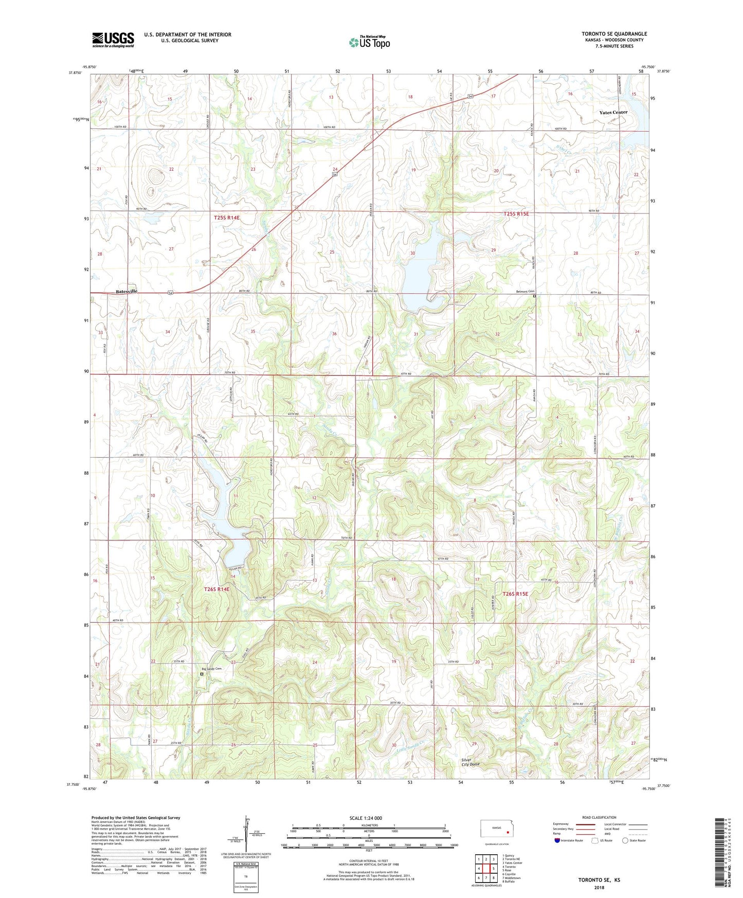
2022 topographic map quadrangle Toronto SE in the state of Kansas. Scale: 1:24000. Based on the newly updated USGS 7.5' US Topo map series, this map is in the following counties: Woodson. The map contains contour data, water features, and other items you are used to seeing on USGS maps, but also has updated roads and other features. This is the next generation of topographic maps. Printed on high-quality waterproof paper with UV fade-resistant inks.
Quads adjacent to this one:
West: Toronto
Northwest: Quincy
North: Toronto NE
Northeast: Yates Center
East: Rose
Southeast: Buffalo
South: Middletown
Southwest: Coyville
This map covers the same area as the classic USGS quad with code o37095g7.
Contains the following named places: Batesville, Bayless School, Belmont Cemetery, Belmont School, Big Sandy Cemetery, Big Sandy Oil Field, Big Sandy School, City of Yates Center, Liberal Hill School, Mount Pleasant School, Myra, Oak Grove School, Prairie View School, Silver City Dome, Silver City Oil Field, Township of Belmont, Woodson County State Park, Woodson County State Park Dam, Woodson State Fishing Lake and Wildlife Area, Yates Center Oil Field, Yates Center Reservoir