MyTopo
Coyville Kansas US Topo Map
Couldn't load pickup availability
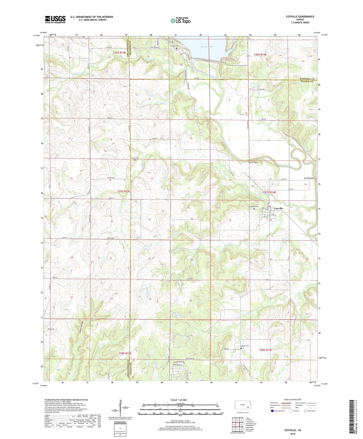
2022 topographic map quadrangle Coyville in the state of Kansas. Scale: 1:24000. Based on the newly updated USGS 7.5' US Topo map series, this map is in the following counties: Wilson, Greenwood, Woodson. The map contains contour data, water features, and other items you are used to seeing on USGS maps, but also has updated roads and other features. This is the next generation of topographic maps. Printed on high-quality waterproof paper with UV fade-resistant inks.
Quads adjacent to this one:
West: Fall River Lake
Northwest: Neal
North: Toronto
Northeast: Toronto SE
East: Middletown
Southeast: Fredonia
South: New Albany
Southwest: Fall River
This map covers the same area as the classic USGS quad with code o37095f8.
Contains the following named places: Brush Creek, Caley Cemetery, Carlisle Branch, Carlisle Cemetery, Carlisle Church, City of Coyville, Coyville, Coyville Cemetery, Cross Timbers State Park Honor Camp Wastewater Treatment Facility, Cross Timbers State Park Rangers Office, Greathouse Creek, Hunter Cemetery, Liberty School, Marr Bridge, McVey Bridge, Meadow Creek, Morgan Valley School, Pig Creek, Ross Branch, Ross Branch School, Row Valley School, Shawnee School, Toronto Dam, Township of Verdigris, Triumph School, Westminster Woods Camp, Wilson County Rural Fire District Station 18, Woodson Cove