MyTopo
Middletown Kansas US Topo Map
Couldn't load pickup availability
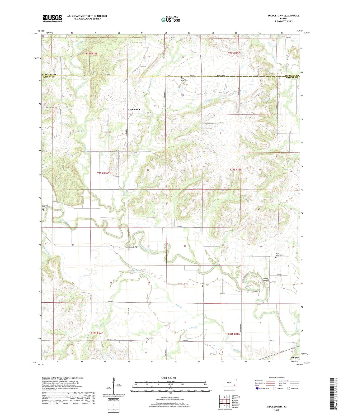
2022 topographic map quadrangle Middletown in the state of Kansas. Scale: 1:24000. Based on the newly updated USGS 7.5' US Topo map series, this map is in the following counties: Wilson, Woodson. The map contains contour data, water features, and other items you are used to seeing on USGS maps, but also has updated roads and other features. This is the next generation of topographic maps. Printed on high-quality waterproof paper with UV fade-resistant inks.
Quads adjacent to this one:
West: Coyville
Northwest: Toronto
North: Toronto SE
Northeast: Rose
East: Buffalo
Southeast: Altoona
South: Fredonia
Southwest: New Albany
This map covers the same area as the classic USGS quad with code o37095f7.
Contains the following named places: Benedict, Buffalo Creek, Farmington Cemetery, Farmington Church, Greystone, Independence School, Lamb School, Leeper Bridge, Little Sandy Cemetery, Little Sandy Creek, Little Sandy School, Maple Grove Cemetery, Maple Grove School, Middletown, Moss Bridge, North Clark School, Rock Creek, Round Top, Sandy Creek, Shafer Lake, Township of Webster, Trimmell Cemetery, Walnut Creek, West Buffalo School