MyTopo
Pfeifer Kansas US Topo Map
Couldn't load pickup availability
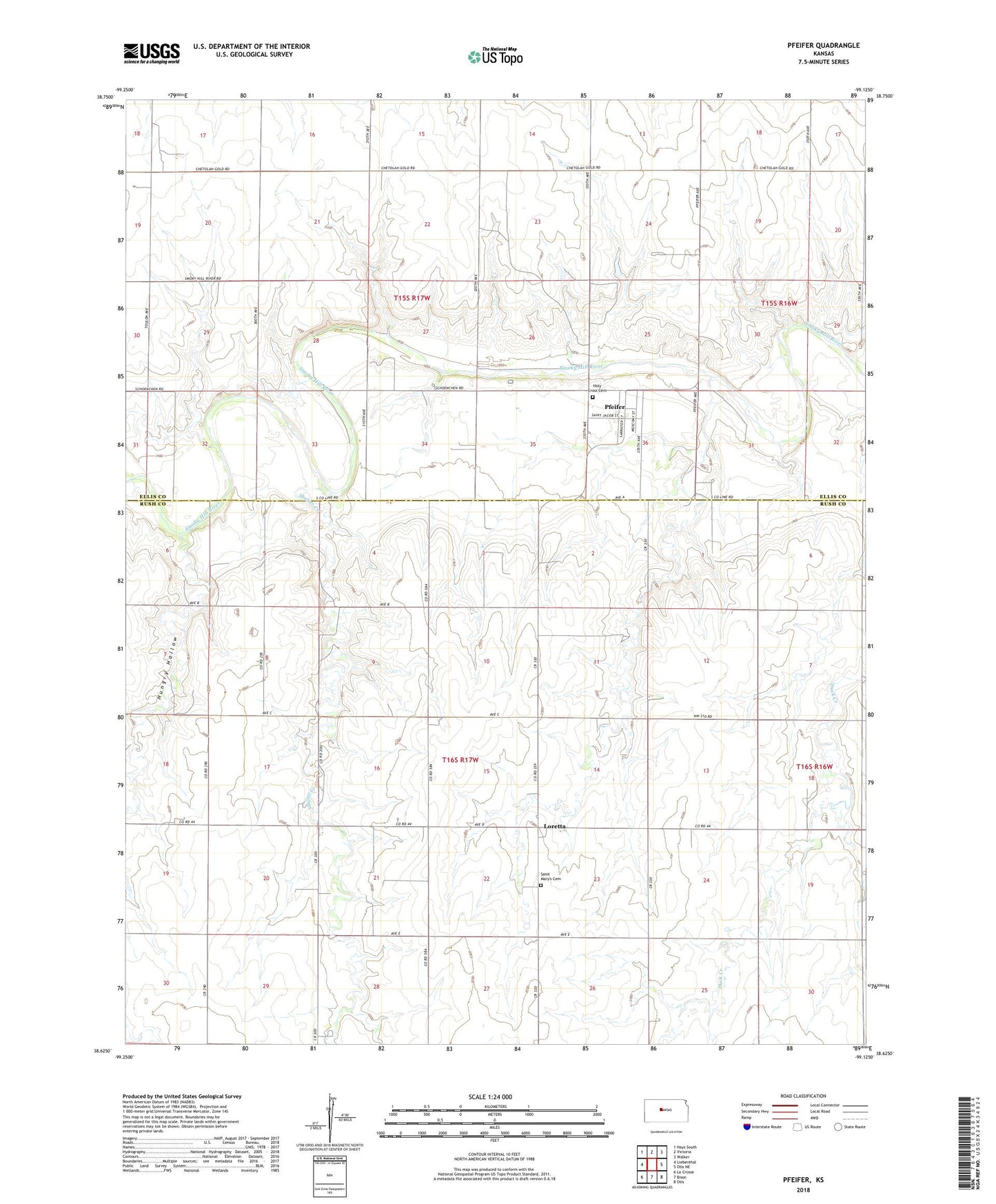
2022 topographic map quadrangle Pfeifer in the state of Kansas. Scale: 1:24000. Based on the newly updated USGS 7.5' US Topo map series, this map is in the following counties: Rush, Ellis. The map contains contour data, water features, and other items you are used to seeing on USGS maps, but also has updated roads and other features. This is the next generation of topographic maps. Printed on high-quality waterproof paper with UV fade-resistant inks.
Quads adjacent to this one:
West: Liebenthal
Northwest: Hays South
North: Victoria
Northeast: Walker
East: Otis NE
Southeast: Otis
South: Bison
Southwest: La Crosse
This map covers the same area as the classic USGS quad with code o38099f2.
Contains the following named places: Easdale, Holy Cross Cemetery, Hungry Hollow, Loretta, Pfeifer, Saint Mary's Cemetery, Shelter Creek, Township of Freedom, Township of Illinois, ZIP Code: 67660