MyTopo
Horton NW Kansas US Topo Map
Couldn't load pickup availability
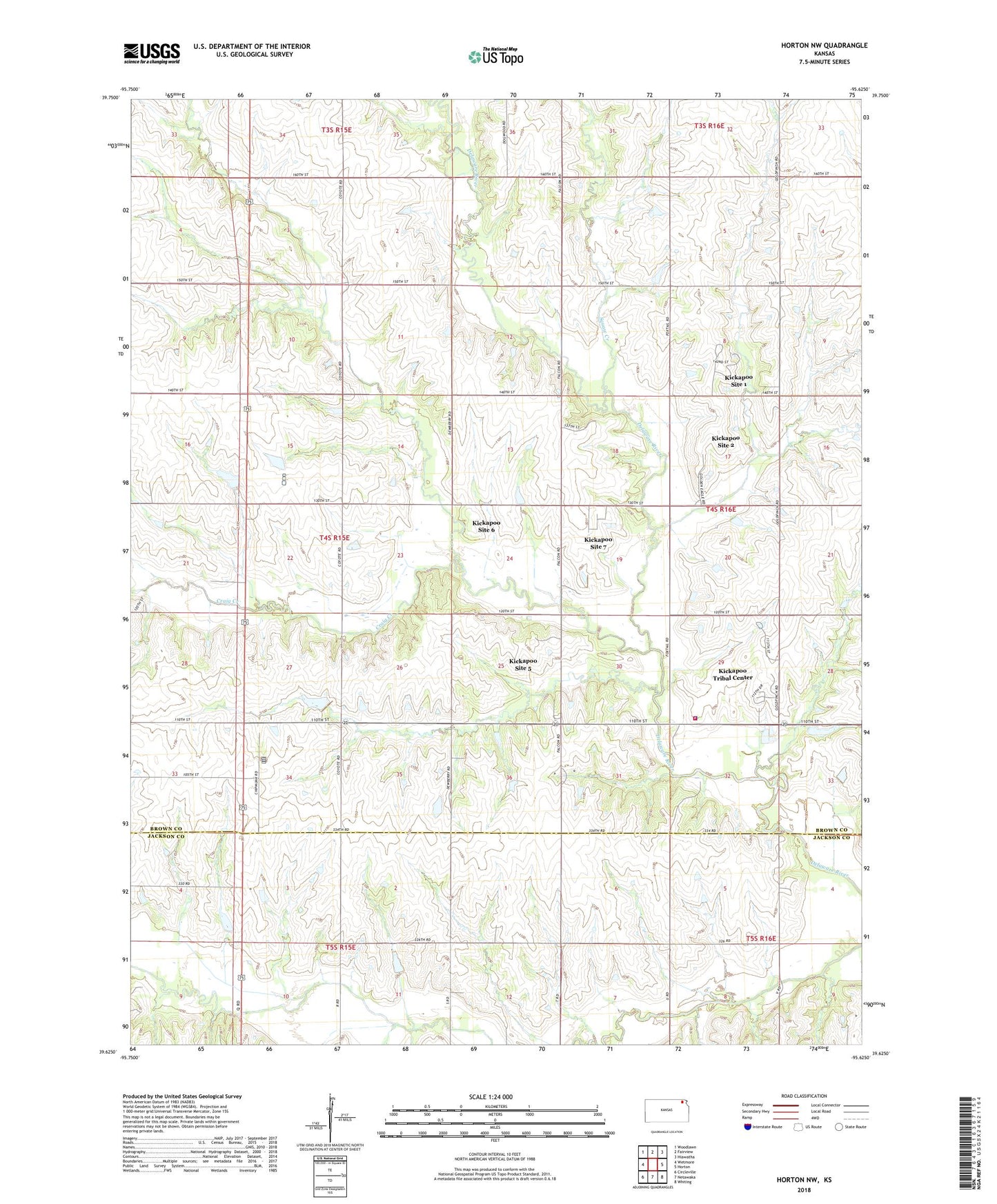
2023 topographic map quadrangle Horton NW in the state of Kansas. Scale: 1:24000. Based on the newly updated USGS 7.5' US Topo map series, this map is in the following counties: Brown, Jackson. The map contains contour data, water features, and other items you are used to seeing on USGS maps, but also has updated roads and other features. This is the next generation of topographic maps. Printed on high-quality waterproof paper with UV fade-resistant inks.
Quads adjacent to this one:
West: Wetmore
Northwest: Woodlawn
North: Fairview
Northeast: Hiawatha
East: Horton
Southeast: Whiting
South: Netawaka
Southwest: Circleville
This map covers the same area as the classic USGS quad with code o39095f6.
Contains the following named places: Craig Creek, Gray School, Kickapoo Fire Department, Kickapoo Indian Church, Kickapoo Reservation/Sac and Fox Nation Trust Land Joint-Use Area, Kickapoo Site 1 Census Designated Place, Kickapoo Site 2 Census Designated Place, Kickapoo Site 5 Census Designated Place, Kickapoo Site 6 Census Designated Place, Kickapoo Site 7 Census Designated Place, Kickapoo Tribal Center Census Designated Place, Kickapoo Tribal Police Department, Kickapoo Tribe Wastewater Treatment Facility, Squaw Creek, Township of Powhattan, ZIP Codes: 66516, 66527