MyTopo
Horton Kansas US Topo Map
Couldn't load pickup availability
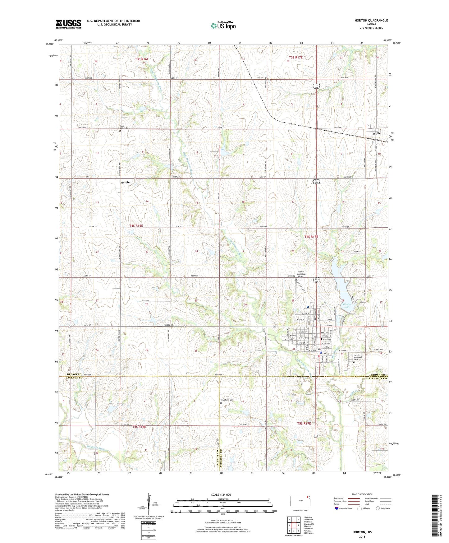
2022 topographic map quadrangle Horton in the state of Kansas. Scale: 1:24000. Based on the newly updated USGS 7.5' US Topo map series, this map is in the following counties: Brown, Atchison, Jackson. The map contains contour data, water features, and other items you are used to seeing on USGS maps, but also has updated roads and other features. This is the next generation of topographic maps. Printed on high-quality waterproof paper with UV fade-resistant inks.
Quads adjacent to this one:
West: Horton NW
Northwest: Fairview
North: Hiawatha
Northeast: Robinson
East: Everest
Southeast: Effingham
South: Whiting
Southwest: Netawaka
This map covers the same area as the classic USGS quad with code o39095f5.
Contains the following named places: Agricultural Partners Co - Operative Grain Elevator Number 9, Church of the Lord Jesus Christ, City of Horton, City of Willis, First Baptist Church, First Christian Church, Horton, Horton City Hall, Horton Community Center Blue Building, Horton Community Hospital, Horton Elementary School, Horton Fire Department, Horton First United Methodist Church, Horton High School, Horton Lakeview Country Club, Horton Municipal Airport, Horton Municipal Cemetery, Horton Municipal Power Plant, Horton Police Department, Horton Post Office, Horton Public Library, Horton Wastewater Plant, Kansas Department of Transportation Area 11 Shop, Kickapoo Reservation, Mercier, Mission Creek, Mission Lake, Mission Lake Camp, Mission Lake Dam, Muddy Creek, Otter Creek, Saint Leo's Catholic Church, Saint Peter's Cemetery, South Brown County Unified School District Office, Township of Mission, Wheatland Cemetery, Willis, Willis Christian Church, Willis Wastewater Plant, ZIP Code: 66439