MyTopo
Wolcott Kansas US Topo Map
Couldn't load pickup availability
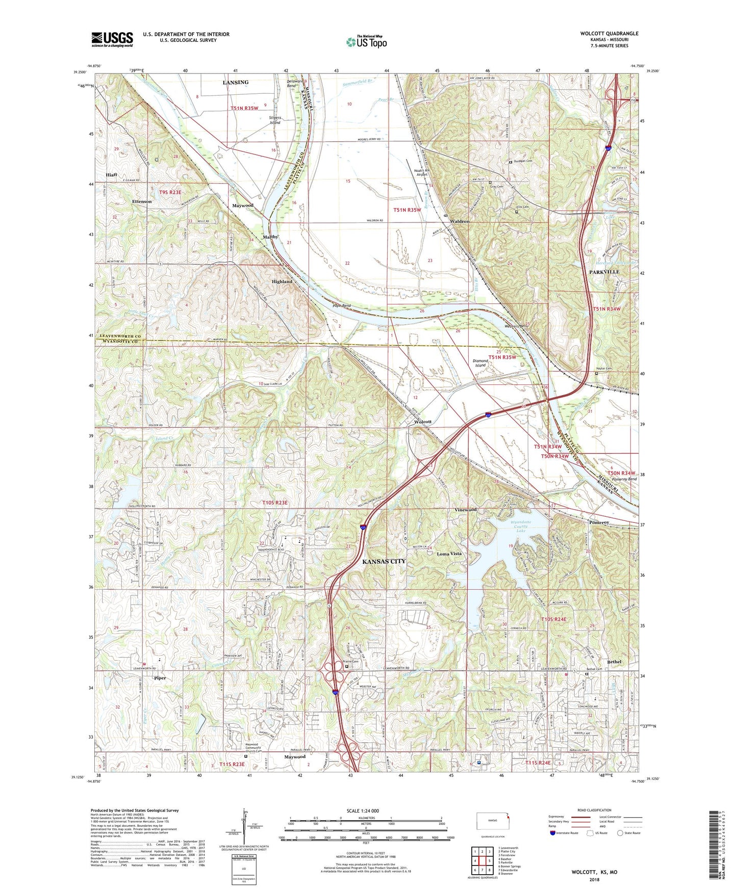
2022 topographic map quadrangle Wolcott in the states of Kansas, Missouri. Scale: 1:24000. Based on the newly updated USGS 7.5' US Topo map series, this map is in the following counties: Wyandotte, Platte, Leavenworth. The map contains contour data, water features, and other items you are used to seeing on USGS maps, but also has updated roads and other features. This is the next generation of topographic maps. Printed on high-quality waterproof paper with UV fade-resistant inks.
Quads adjacent to this one:
West: Basehor
Northwest: Leavenworth
North: Platte City
Northeast: Ferrelview
East: Parkville
Southeast: Shawnee
South: Edwardsville
Southwest: Bonner Springs
Contains the following named places: Arrowhead Shopping Center, Bethel, Bethel Cemetery, Brown Branch, Brush Creek, Buchan, Camp Number Two, Center Point School, Cocayne - Gray Cemetery, Conner Creek Wastewater Treatment Facility, Connor Creek, Delaware City, Delaware Elementary School, Diamond Island, District Number 45 School, Dunagan Cemetery, Ellis Branch, Ellis Cemetery, Ettenson, First Baptist Church of Bethel, Grandview Christian Church, Hancock Airport, Hereford Valley Lake, Hereford Valley Lake Dam, Hiatt, Highland, Honey Creek, Island Creek, Island Creek School, Kansas City Kansas Fire Department Station 4, Kansas City Kansas Fire Department Station 8, Lakeside Speedway, Little Snell Creek, Loma Vista, Lowell Brune Elementary School, Maltby, Marshall Creek, Marshall Creek Dam, Maywood, Maywood Community Church Cemetery, Naylor Creek, Noah's Ark Airport, Open Door Baptist Church, Open Door Christian School, Parker Hollow, Parkway Plaza, Pearl Branch, Piper, Piper East Elementary School, Piper Elementary School East, Piper Elementary School West, Piper High School, Piper Middle School, Piper Plaza, Piper Unified School District Office, Piper West Elementary School, Pleasant Ridge School, Pomeroy, Pomeroy Bend, Pomeroy School, Pope Bend, Prairie Cemetery, Providence Airport, Providence Health Library, Providence Medical Center, Providence Medical Center Heliport, Providence Place Nursing Home, Roman Catholic Archdiocese of Kansas City in Kansas, Sevenmile Creek, Smart Lake, Smart Lake Dam, Summerfield Branch, Thunder Lake Speedway, Township of Delaware, Township of Prairie, Township of Waldron, Village Community Church, Vinewood, Walcott School, Waldron, Waldron Post Office, Weavers Bend, Weimar, White Church, White Church Elementary School, Williams School, Wolcott, Wyandotte County Kansas City Park Rangers, Wyandotte County Lake, Wyandotte County Park, ZIP Codes: 64092, 66109