MyTopo
Bardstown Kentucky US Topo Map
Couldn't load pickup availability
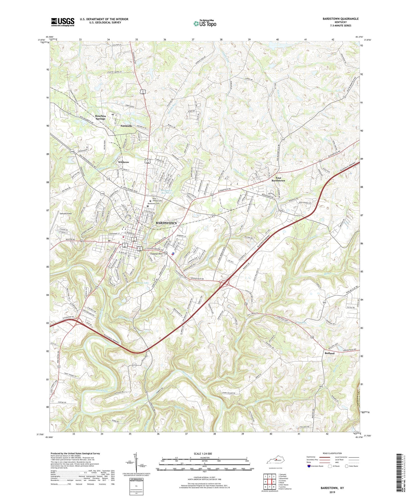
2022 topographic map quadrangle Bardstown in the state of Kentucky. Scale: 1:24000. Based on the newly updated USGS 7.5' US Topo map series, this map is in the following counties: Nelson. The map contains contour data, water features, and other items you are used to seeing on USGS maps, but also has updated roads and other features. This is the next generation of topographic maps. Printed on high-quality waterproof paper with UV fade-resistant inks.
Quads adjacent to this one:
West: Cravens
Northwest: Samuels
North: Fairfield
Northeast: Bloomfield
East: Maud
Southeast: Saint Catharine
South: Loretto
Southwest: New Haven
This map covers the same area as the classic USGS quad with code o37085g4.
Contains the following named places: Alexander Walters Historical Marker, Bardstown, Bardstown Cemetery, Bardstown Division, Bardstown Fire Department, Bardstown Historical Marker, Bardstown Police Department, Bardstown Post Office, Bardstown Reservoir, Bardstown-Louisville Turnpike Historical Marker, Barton Lake, Bear Creek, Ben Johnson House Historical Marker, Benedict Joseph Flaget Historical Marker, Bethlehem Academy Historical Marker, Bethlehem High School, Botland, Bourbon Springs, Bragg and Morgan Encampments Historical Marker, Cane Run, City of Bardstown, Coes Creek, Diocese of Bardstown Historical Marker, Early Times, East Bardstown, Edgewood Historical Marker, Federal Hill, Federal Hill Historical Marker, Fromans Road and Station Historical Marker, Gilkey Run, John Fitch Historical Marker, Mill Creek, Murray Run, My Old Kentucky Home State Park, Nazareth, Nazareth College and Academy, Nazareth College Historical Marker, Nazareth Post Office, Needmore, Nelson County, Nelson County Dispatch Center, Nelson County Emergency Medical Services, Nelson County Historical Marker, Nelson County Sheriff's Office, Quirks Branch, Rowan Creek, Rowan-Chambers Duel Historical Marker, Saint Joseph Preparatory School, Saint Josephs Cemetery, Saint Monica School, Saint Thomas Church, Saint Thomas Farm Historical Marker, Salem Academy Historical Marker, Samuels Field, South Bardstown, Spalding Hall Historical Marker, Successful Amputation Historical Marker, Sugar Camp Run, Town Creek, WBRT-AM (Bardstown), West Bardstown, Wickland Church, Wickland Historical Marker, Withrow, Withrow Creek, WOKH-FM (Bardstown), ZIP Codes: 40004, 40048