MyTopo
New Haven Kentucky US Topo Map
Couldn't load pickup availability
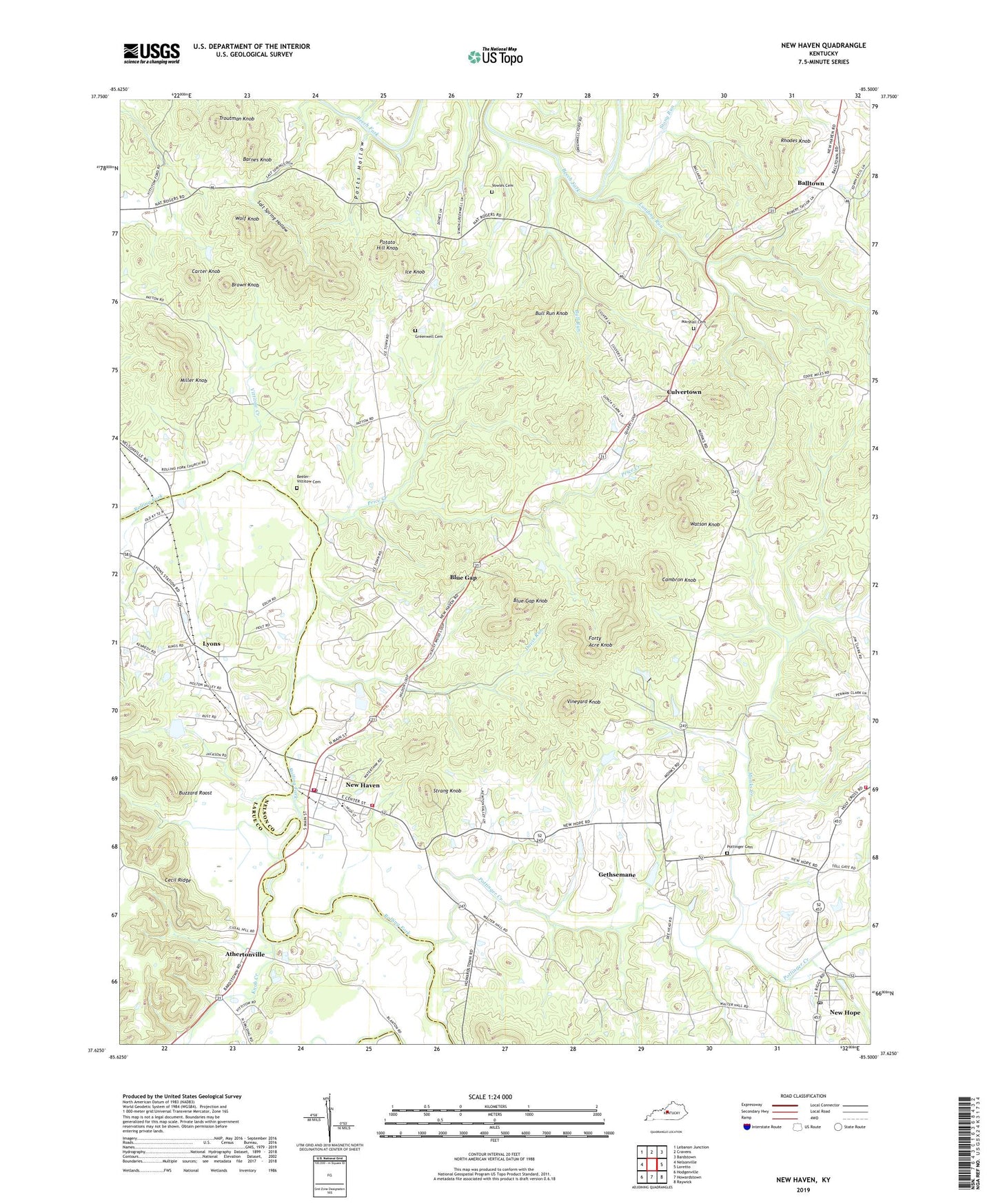
2022 topographic map quadrangle New Haven in the state of Kentucky. Scale: 1:24000. Based on the newly updated USGS 7.5' US Topo map series, this map is in the following counties: Nelson, Larue. The map contains contour data, water features, and other items you are used to seeing on USGS maps, but also has updated roads and other features. This is the next generation of topographic maps. Printed on high-quality waterproof paper with UV fade-resistant inks.
Quads adjacent to this one:
West: Nelsonville
Northwest: Lebanon Junction
North: Cravens
Northeast: Bardstown
East: Loretto
Southeast: Raywick
South: Howardstown
Southwest: Hodgenville
This map covers the same area as the classic USGS quad with code o37085f5.
Contains the following named places: Abbey of Our Lady of Gethsemani, Abbey of Our Lady of Gethsemani Historical Marker, Athertonville, Balltown, Barnes Knob, Beeler - Vittitow Cemetery, Blue Gap, Blue Gap Knob, Brown Knob, Bull Run, Bull Run Knob, Buzzard Roost, Cambron Knob, Carter Knob, City of New Haven, Culvertown, Davis Run, Forty Acre Knob, Gethsemane, Goodwin Fort Historical Marker, Greenwell Cemetery, Ice Knob, Icetown Church, Knob Creek, Landing Run, Lyons, Marshall Cemetery, Miller Knob, Monks Creek, New Haven, New Haven Division, New Haven Fire Department, New Haven Police Department, New Haven Post Office, New Hope, New Hope Census Designated Place, New Hope Fire Department, New Hope Post Office, Potato Hill Knob, Pottinger Cemetery, Pottinger Creek, Pottingers Station Historical Marker, Potts Hollow, Price Creek, Rhodes Knob, Rolling Fork Baptist Church, Rolling Fork Church, Rolling Fork Fire Department, Salt Spring Hollow, Samuel Pottinger Settlement, Steam Engine 152 Historical Marker, Stony Run, Strang Knob, Troutman Knob, Vineyard Knob, Vittitow Creek, Vowles Cemetery, Watson Knob, Wolf Knob, ZIP Codes: 40051, 40107