MyTopo
Fairfield Kentucky US Topo Map
Couldn't load pickup availability
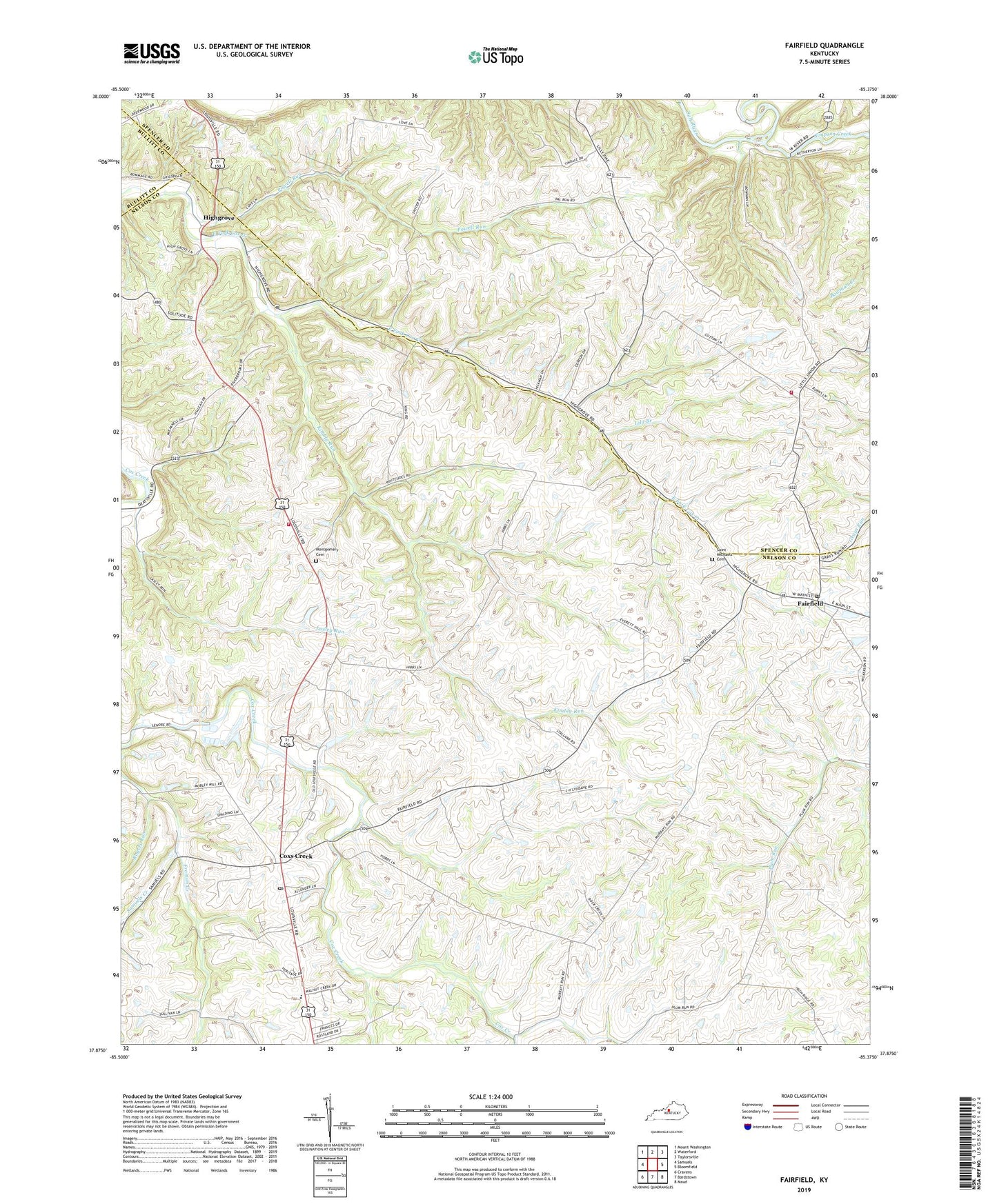
2022 topographic map quadrangle Fairfield in the state of Kentucky. Scale: 1:24000. Based on the newly updated USGS 7.5' US Topo map series, this map is in the following counties: Nelson, Spencer, Bullitt. The map contains contour data, water features, and other items you are used to seeing on USGS maps, but also has updated roads and other features. This is the next generation of topographic maps. Printed on high-quality waterproof paper with UV fade-resistant inks.
Quads adjacent to this one:
West: Samuels
Northwest: Mount Washington
North: Waterford
Northeast: Taylorsville
East: Bloomfield
Southeast: Maud
South: Bardstown
Southwest: Cravens
This map covers the same area as the classic USGS quad with code o37085h4.
Contains the following named places: Caney Fork, City of Fairfield, Cox Creek Baptist Church, Cox Creek School, Coxs Creek, Coxs Creek Division, Coxs Creek Post Office, Coxs Station Historical Marker, Downs Ford, Fairfield, Fairfield Post Office, Goodwin Spring, Highgrove, Highgrove School, Kimbly Run, Lasley Run, Lily Branch, Little Union Church, Montgomery Cemetery, Nelson County Fire and Rescue Station 82, Plum Run, Powell Run, Riverview Church, Rogers Run, Saint Michaels Cemetery, Samuels Creek, School Number Fifteen, Simpson Creek, Taylorsville - Spencer County Fire Protection District Station 6, Upper Grove, ZIP Codes: 40013, 40020