MyTopo
Cravens Kentucky US Topo Map
Couldn't load pickup availability
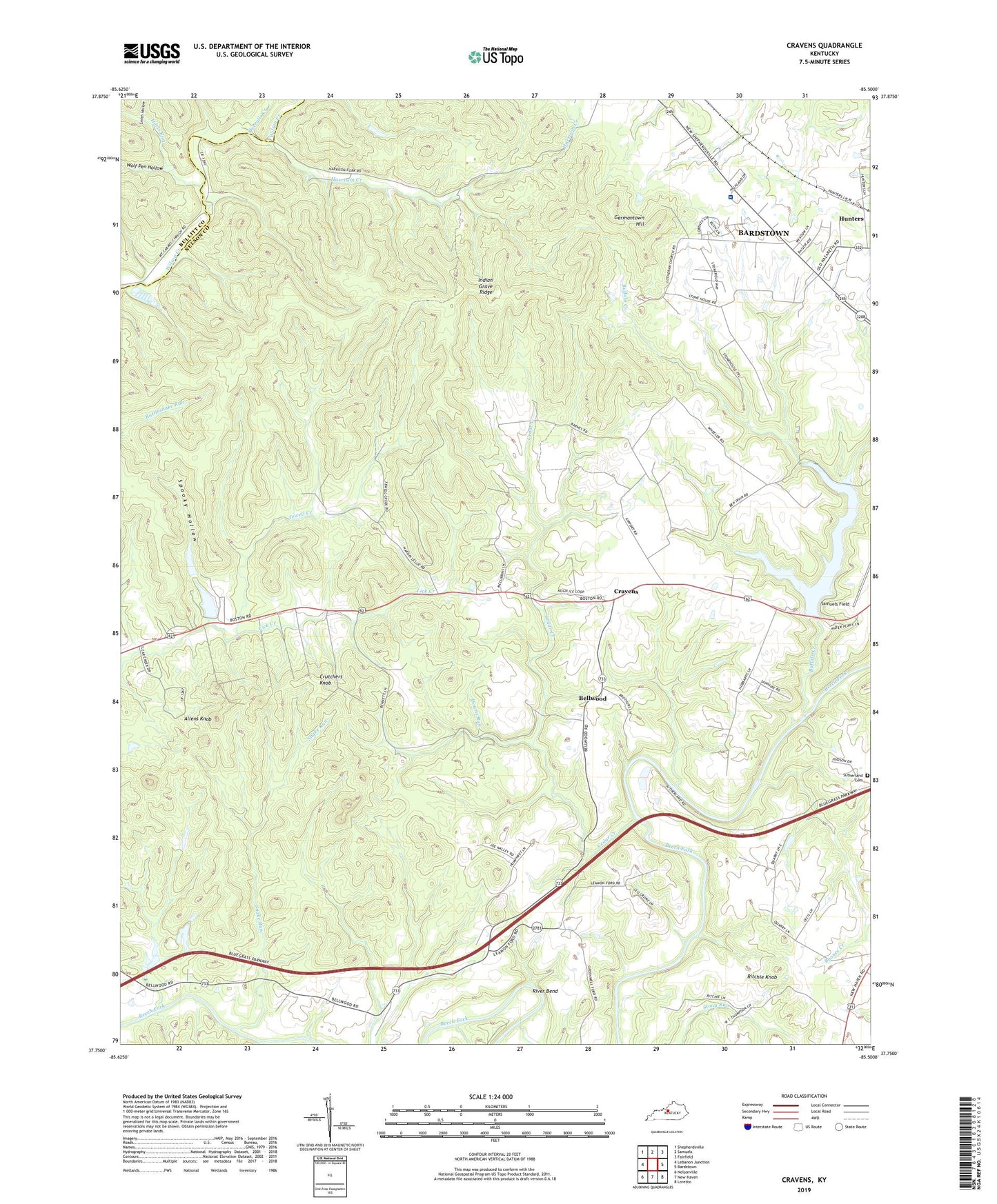
2022 topographic map quadrangle Cravens in the state of Kentucky. Scale: 1:24000. Based on the newly updated USGS 7.5' US Topo map series, this map is in the following counties: Nelson, Bullitt. The map contains contour data, water features, and other items you are used to seeing on USGS maps, but also has updated roads and other features. This is the next generation of topographic maps. Printed on high-quality waterproof paper with UV fade-resistant inks.
Quads adjacent to this one:
West: Lebanon Junction
Northwest: Shepherdsville
North: Samuels
Northeast: Fairfield
East: Bardstown
Southeast: Loretto
South: New Haven
Southwest: Nelsonville
This map covers the same area as the classic USGS quad with code o37085g5.
Contains the following named places: Allens Knob, Bellwood, Boones Creek, Boston Division, Buffalo Creek, Cedar Creek, Cedar Creek Baptist Church, Cravens, Crutchers Knob, Downs Run, First Cedar Creek Baptist Church Historical Marker, Flaget Memorial Hospital, Germantown Hill, Greene County Parachute Center Airport, Harrison Creek, Harts Run, Hunters, Indian Grave Ridge, Nelson Church, Overalls Creek, Ritchie Knob, River Bend, Rogers Station Historical Marker, Smith Hollow, Snake Run, Spooky Hollow, Sutherland Cemetery, Sympson Lake, Tewell Creek, Wolf Pen Hollow