MyTopo
Panola Kentucky US Topo Map
Couldn't load pickup availability
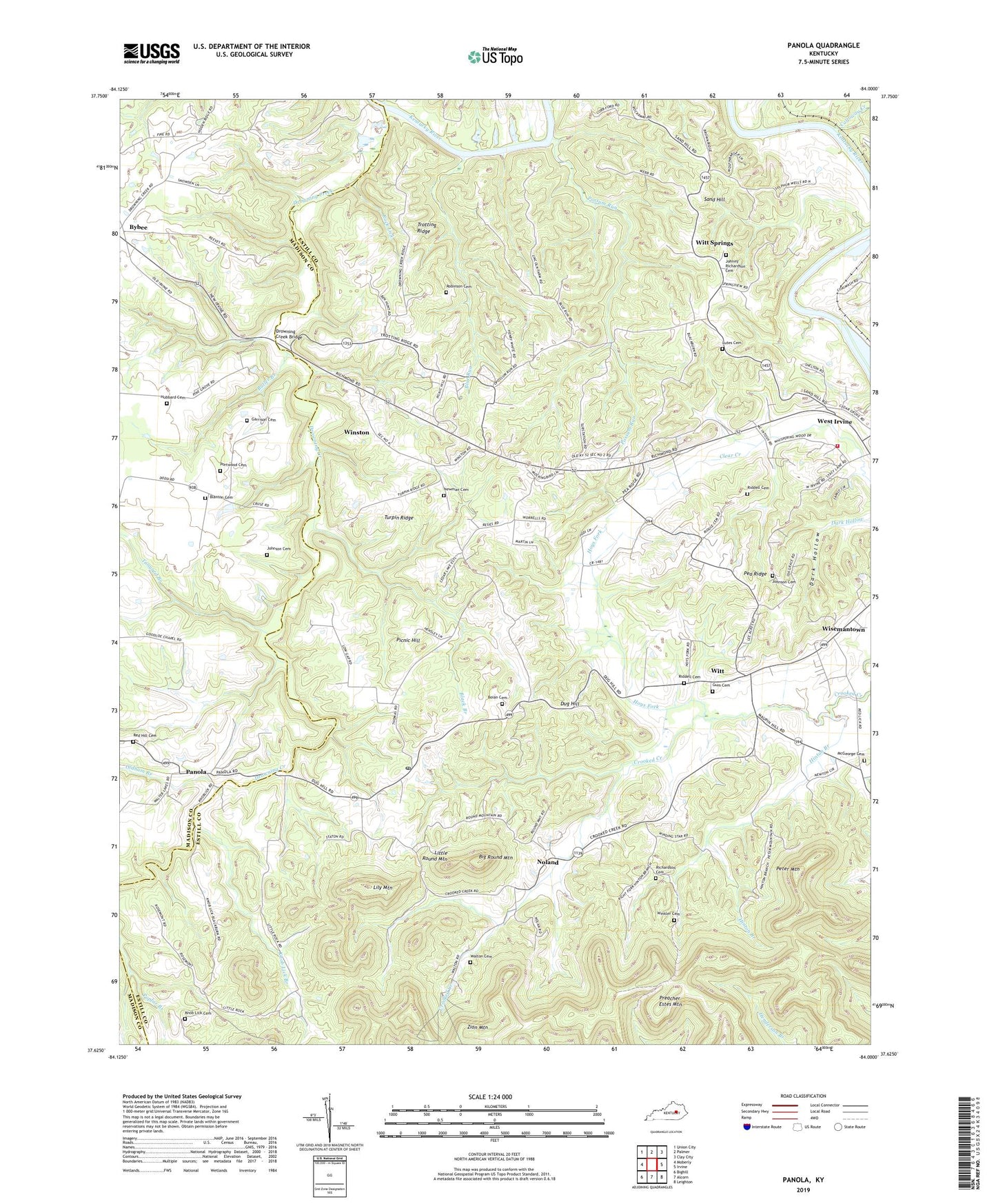
2022 topographic map quadrangle Panola in the state of Kentucky. Scale: 1:24000. Based on the newly updated USGS 7.5' US Topo map series, this map is in the following counties: Estill, Madison. The map contains contour data, water features, and other items you are used to seeing on USGS maps, but also has updated roads and other features. This is the next generation of topographic maps. Printed on high-quality waterproof paper with UV fade-resistant inks.
Quads adjacent to this one:
West: Moberly
Northwest: Union City
North: Palmer
Northeast: Clay City
East: Irvine
Southeast: Leighton
South: Alcorn
Southwest: Bighill
This map covers the same area as the classic USGS quad with code o37084f1.
Contains the following named places: Alexander Hill Home, Alger Post Office, Amerina School, Big Round Mountain, Black Branch, Blanton Cemetery, Blue Bank Post Office, Blue Run, Boian Cemetery, Butler Branch, Bybee, Calla Airport, Calloway Creek, Calloway Crossing, Cedar Grove, Cedar Grove Church, Cedar Lakes Estates, Crooked Creek, Crooked Creek Church, Crooked Creek School, Dark Hollow, Drowing Creek, Drowning Creek, Drowning Creek Bridge, Drownville, Dug Hill, Estill County Fire Department, Fainville Post Office, Garrison Cemetery, Gum Cemetery, Hinton Branch, Hoys Fork, Hoys Fork School, Hubbard Cemetery, Johnny Richardson Cemetery, Johnson Cemetery, King Station, King Station Post Office, Knob Lick, Knob Lick Branch, Knob Lick Cemetery, Knob Lick School, Lily Mountain, Little Rock, Little Rock Railroad Station, Little Round Mountain, Lutes Cemetery, Maddie, Maddle School, McGeorge Cemetery, Newman Cemetery, Newman Stand, Noland, Noland Post Office, Oldham Branch, Oldham Ferry, Panola, Panola Post Office, Panola Railroad Station, Pea Ridge, Pea Ridge School, Peter Mountain, Picnic Hill, Portwood Cemetery, Portwood Post Office, Possum Run, Preacher Estes Mountain, Red Hill Cemetery, Reges Post Office, Reges Railroad Station, Rice Railroad Station, Rice Station, Rice Station Post Office, Richardson Cemetery, Riddell Cemetery, Robinson Cemetery, Rock Lick, Sand Hill, Sand Hill School, Stump Post Office, Tanyard Branch, Thomas, Thomas Point on Postal Route, Thomas School, Trotting Ridge, Turpin Ridge, Vogel Post Office, Walton Cemetery, Weeden Post Office, Winkler Cemetery, Winston, Winston Post Office, Winston-West Irvine Division, Wisemantown, Wisemantown Post Office, Witt, Witt Post Office, Witt Springs, Witt Springs Post Office, Witt Springs School, Zion Mountain