MyTopo
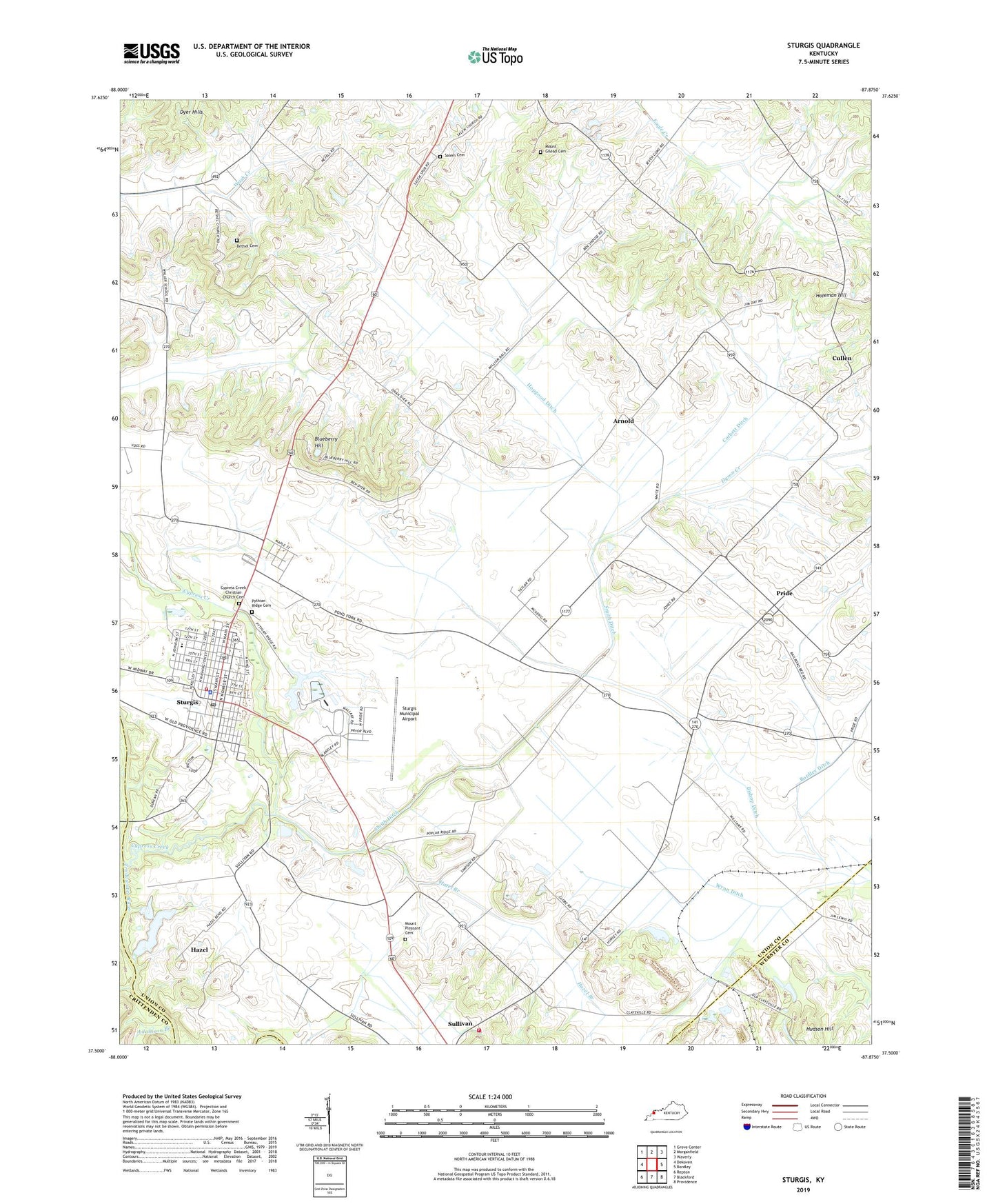
Sturgis Kentucky US Topo Map
Couldn't load pickup availability
2022 topographic map quadrangle Sturgis in the state of Kentucky. Scale: 1:24000. Based on the newly updated USGS 7.5' US Topo map series, this map is in the following counties: Union, Webster, Crittenden. The map contains contour data, water features, and other items you are used to seeing on USGS maps, but also has updated roads and other features. This is the next generation of topographic maps. Printed on high-quality waterproof paper with UV fade-resistant inks.
Quads adjacent to this one:
West: Dekoven
Northwest: Grove Center
North: Morganfield
Northeast: Waverly
East: Bordley
Southeast: Providence
South: Blackford
Southwest: Repton
This map covers the same area as the classic USGS quad with code o37087e8.
Contains the following named places: Adamson Branch, Arnold, Bethany Church, Bethel Cemetery, Bishop Ditch, Blueberry Hill, Bordley Ditch, City of Sturgis, Corbett Ditch, Cullen, Cypress Creek, Cypress Creek Christian Church Cemetery, Dyer Hills, Dyson Creek, Eberly, Hazel, Hazel Branch, Holeman Hill, Hopgood Ditch, Hudson Hill, Kern Orchard, Mount Gilead Cemetery, Old Mount Pleasant Cemetery, Pride, Pythian Ridge Cemetery, Salem Cemetery, Shrote, Smith Ditch, Sturgis, Sturgis Army Air Field, Sturgis Division, Sturgis Fire Department, Sturgis Municipal Airport, Sturgis Police Department, Sturgis Post Office, Sullivan Community Fire Department, Wynn Ditch