MyTopo
Morganfield Kentucky US Topo Map
Couldn't load pickup availability
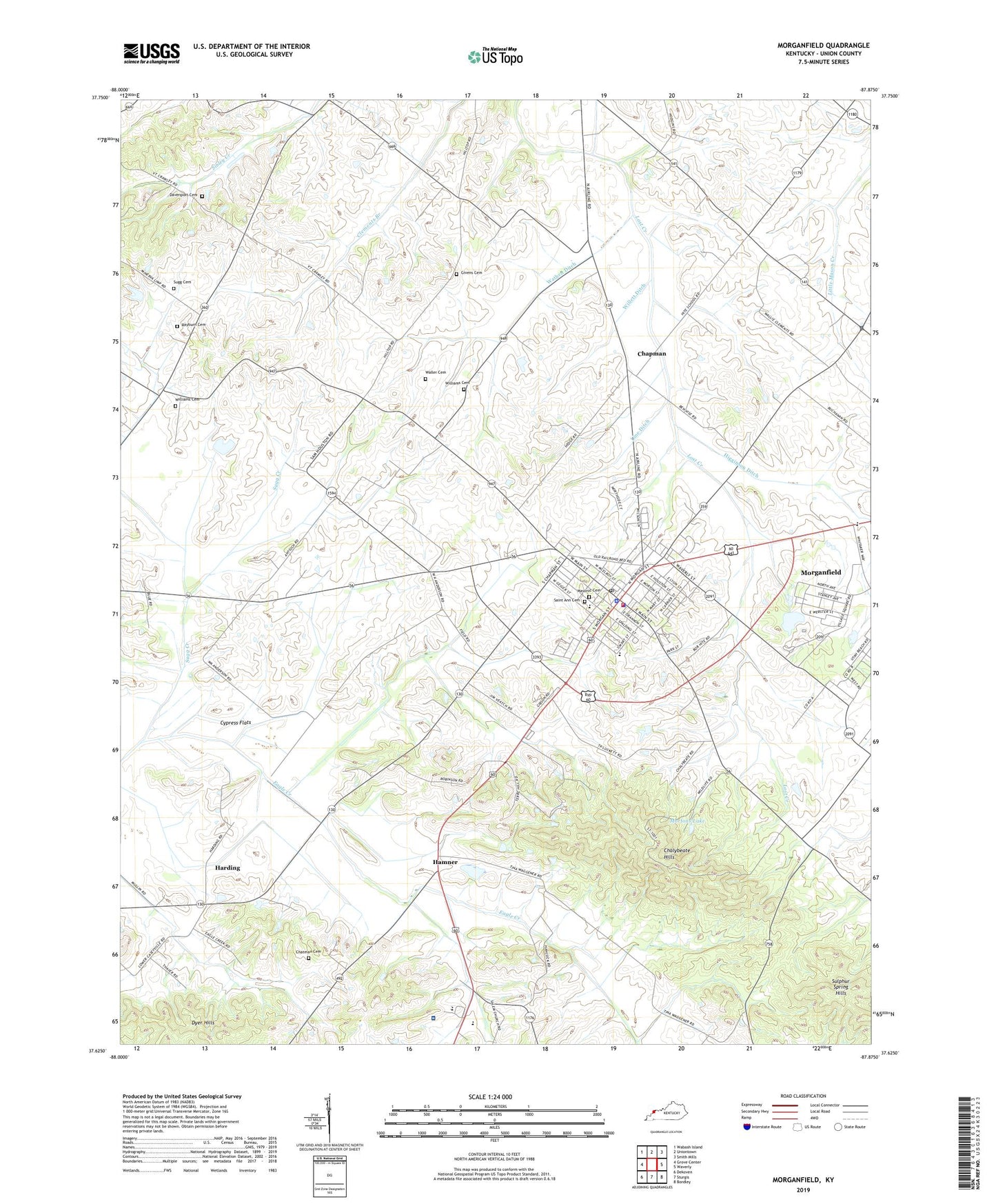
2022 topographic map quadrangle Morganfield in the state of Kentucky. Scale: 1:24000. Based on the newly updated USGS 7.5' US Topo map series, this map is in the following counties: Union. The map contains contour data, water features, and other items you are used to seeing on USGS maps, but also has updated roads and other features. This is the next generation of topographic maps. Printed on high-quality waterproof paper with UV fade-resistant inks.
Quads adjacent to this one:
West: Grove Center
Northwest: Wabash Island
North: Uniontown
Northeast: Smith Mills
East: Waverly
Southeast: Bordley
South: Sturgis
Southwest: Dekoven
This map covers the same area as the classic USGS quad with code o37087f8.
Contains the following named places: Antioch Church, Chalybeate Hills, Chapman, Chatman Cemetery, City of Morganfield, Cypress Flats, Davenport Cemetery, Eagle Creek, Givens Cemetery, Hamner, Harding, Higginson Ditch, Higginson-Henry Wildlife Management Area, Joel Sugg Cemetery, Line Ditch, Masonic Cemetery, Methodist Hospital Union County, Morganfield, Morganfield Division, Morganfield Fire Department, Morganfield Police Department, Morganfield Post Office, Mortons Lake, Reburn Cemetery, Saint Ann Cemetery, Saint Ann School, Sugg Creek, Sulphur Spring Hills, Union County, Union County Sheriff's Office, Waller Cemetery, Wathen Ditch, Willett Ditch, Williams Cemetery, WMSK-AM (Morganfield), WMSK-FM (Morganfield), ZIP Code: 42437