MyTopo
Burtonville Kentucky US Topo Map
Couldn't load pickup availability
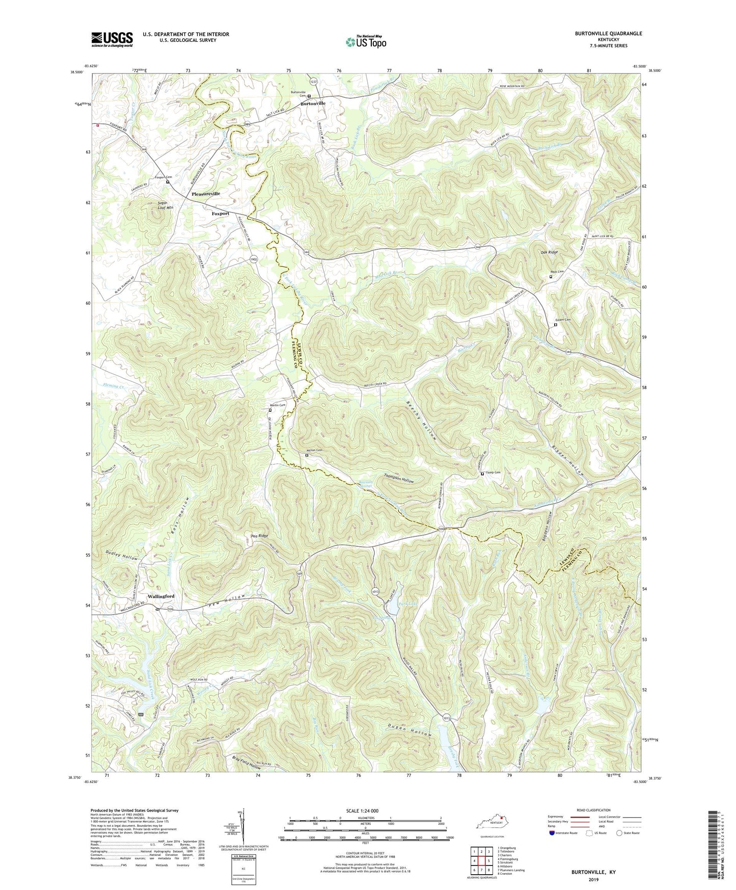
2022 topographic map quadrangle Burtonville in the state of Kentucky. Scale: 1:24000. Based on the newly updated USGS 7.5' US Topo map series, this map is in the following counties: Fleming, Lewis. The map contains contour data, water features, and other items you are used to seeing on USGS maps, but also has updated roads and other features. This is the next generation of topographic maps. Printed on high-quality waterproof paper with UV fade-resistant inks.
Quads adjacent to this one:
West: Flemingsburg
Northwest: Orangeburg
North: Tollesboro
Northeast: Charters
East: Stricklett
Southeast: Cranston
South: Plummers Landing
Southwest: Hillsboro
This map covers the same area as the classic USGS quad with code o38083d5.
Contains the following named places: Beechy Creek, Beechy Hollow, Bigden Hollow, Bogdens Hollow, Bowman Springs, Bray Field Hollow, Buck Lick Branch, Burtonville, Burtonville Cemetery, Burtonville Post Office, Carpenter Corners, Carpenters Store, Carpentersville, Cowan School, Dudley Hollow, Dugan Hollow, East Prong Anderson Branch, Eddman Branch, Esham Cemetery, Fox Springs, Foxport, Foxport Baptist Church, Foxport Cemetery, Fruit Hill Post Office, Martin Cemetery, Mays Cemetery, Million Cemetery, Mount Carmel Volunteer Fire Department, Mount Zion Church, Mount Zion School, Mud Lick Branch, Oak Ridge, Oak Ridge School, Park Lake, Park Lake Resort, Pea Ridge, Pea Ridge Church, Pea Ridge School, Pew Hollow, Pleasant Valley Church, Pleasureville, Poston School, Powderlick Branch, Ross Hollow, Rush Run, Sargent Branch, Sugar Loaf Mountain, Thompson Hollow, Thorp Cemetery, Throp Post Office, Wallingford, Wallingford Post Office, Wooley Creek, ZIP Code: 41093