MyTopo
Tollesboro Kentucky US Topo Map
Couldn't load pickup availability
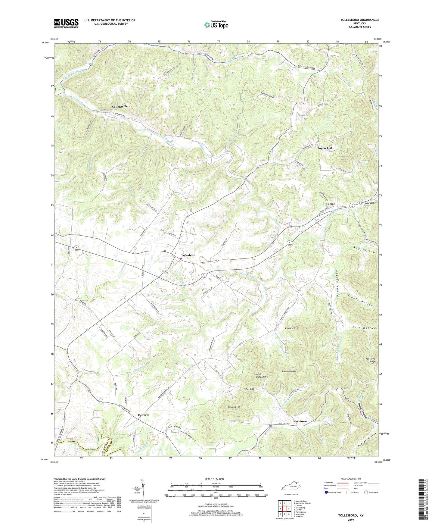
2022 topographic map quadrangle Tollesboro in the state of Kentucky. Scale: 1:24000. Based on the newly updated USGS 7.5' US Topo map series, this map is in the following counties: Lewis, Fleming, Mason. The map contains contour data, water features, and other items you are used to seeing on USGS maps, but also has updated roads and other features. This is the next generation of topographic maps. Printed on high-quality waterproof paper with UV fade-resistant inks.
Quads adjacent to this one:
West: Orangeburg
Northwest: Maysville East
North: Manchester Islands
Northeast: Concord
East: Charters
Southeast: Stricklett
South: Burtonville
Southwest: Flemingsburg
This map covers the same area as the classic USGS quad with code o38083e5.
Contains the following named places: Bethel Church, Bethel Creek, Boggs Post Office, Browns Run, Browns Run School, Cabin Creek Bridge, Cabin Creek Bridge Historical Marker, Cabin Creek Point of Entry Historical Marker, Cabin Creek Post Office, Canaan Church, Canaan School, Clear Creek, Cottageville, East Fork Bethel Creek, East Fork Cabin Creek, Ebenezer Church, Epworth, Epworth Post Office, Eskalapia Hollow, Eskalapia Mountain, Everetts House Post Office, Fite Hollow, Flat Gap, Fry Branch, Gallilee Church, Grog Branch, Happy Hollow, Happy Hollow Church, Happy Hollow School, Indian Creek, Indian Run, May Hollow, McKenzie Post Office, Mount Tabor Church, Myers School, Nashtown, Nashtown Post Office, Oak Hill School, Peach Orchard Hill, Pine Knob, Pine Valley Church, Pine Valley School, Poplar Flat, Ribolt, Ribolt Post Office, Richland School, Ruggles Camp, Salem Church, Stouts Hollow, Tanbark Hill, Thoroughman Branch, Tollesboro, Tollesboro Division, Tollesboro Post Office, Tollesboro Volunteer Fire Department, Trotter Creek, Union Branch, Yellowlick Branch, ZIP Code: 41189