MyTopo
Flemingsburg Kentucky US Topo Map
Couldn't load pickup availability
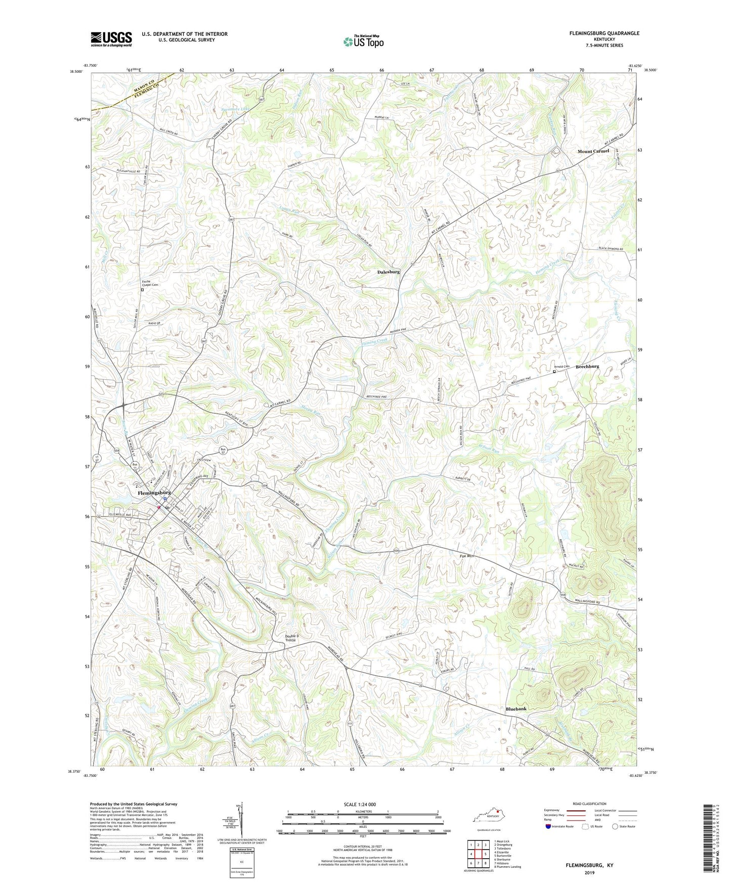
2022 topographic map quadrangle Flemingsburg in the state of Kentucky. Scale: 1:24000. Based on the newly updated USGS 7.5' US Topo map series, this map is in the following counties: Fleming, Mason. The map contains contour data, water features, and other items you are used to seeing on USGS maps, but also has updated roads and other features. This is the next generation of topographic maps. Printed on high-quality waterproof paper with UV fade-resistant inks.
Quads adjacent to this one:
West: Elizaville
Northwest: Mays Lick
North: Orangeburg
Northeast: Tollesboro
East: Burtonville
Southeast: Plummers Landing
South: Hillsboro
Southwest: Sherburne
This map covers the same area as the classic USGS quad with code o38083d6.
Contains the following named places: Acme Post Office, Allison Creek, Arnold Cemetery, Beechbry Post Office, Beechburg, Birthplace of Herman Chittison Historical Marker, Bluebank, Cassidy Creek, Church of Christ in Union, City of Flemingsburg, Cold Spring School, Dalesburg, Dalesburg Post Office, DeBolle School, Double D Trestle, Fitche Chapel Cemetery, Fleming County Emergency Medical Services, Fleming County Historical Marker, Fleming County Sheriff's Offfice, Flemingsburg, Flemingsburg Division, Flemingsburg Police Department, Flemingsburg Post Office, Flemingsburg Volunteer Fire Department, Fox Mountain, James J Andrews Historical Marker, John F Day Historical Marker, Logan Run, Long Knob School, Mount Carmel, Mount Carmel Post Office, Mount Carmel School, Sleepy Run, Sutton Post Office, Sutton School, Sycamore Lake, Town Branch, Turner School, WFLE-AM (Flemingsburg), Wilson Run, ZIP Code: 41041