MyTopo
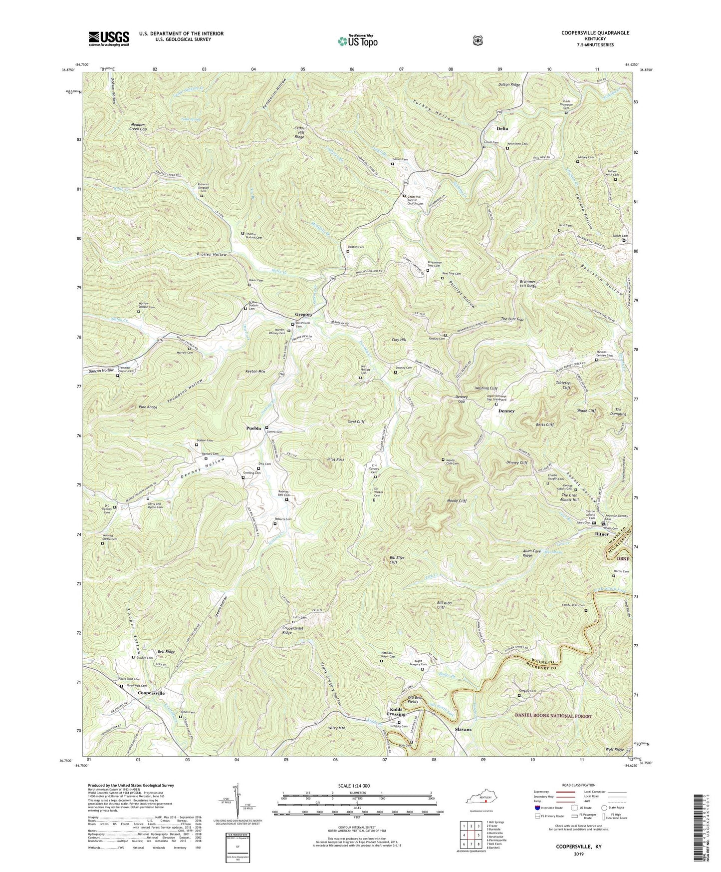
Coopersville Kentucky US Topo Map
Couldn't load pickup availability
Also explore the Coopersville Forest Service Topo of this same quad for updated USFS data
2022 topographic map quadrangle Coopersville in the state of Kentucky. Scale: 1:24000. Based on the newly updated USGS 7.5' US Topo map series, this map is in the following counties: Wayne, McCreary. The map contains contour data, water features, and other items you are used to seeing on USGS maps, but also has updated roads and other features. This is the next generation of topographic maps. Printed on high-quality waterproof paper with UV fade-resistant inks.
Quads adjacent to this one:
West: Monticello
Northwest: Mill Springs
North: Frazer
Northeast: Burnside
East: Nevelsville
Southeast: Barthell
South: Bell Farm
Southwest: Parmleysville
This map covers the same area as the classic USGS quad with code o36084g6.
Contains the following named places: A Salt Spring and Deer Lick, Abbott Hollow, Alum Cave Ridge, Aught Gregory Cemetery, Baker Branch, Baker Cemetery, Bearskin Hollow, Bell Ridge, Betts Cliff, Big Sinking Church, Big Sinking School, Bill Eller Cliff, Bill Kidd Cliff, Blue Spring, Brammer Hill Ridge, Brammer Hill School, Broiles Hollow, Buffalo Wallow, Burk Cemetery, C H Denney Cemetery, Canada Creek Baptist Church, Cave Branch, Cedar Hill Baptist Church Cemetery, Cedar Hill Ridge, Cedar Hill School, Charlie Abbott Cemetery, Charlie Vaughn Cemetery, Chicken Creek, Chicken Hollow, Chrisman-Duncan Cemetery, Clay Hill, Clay Hill Church, Concord Baptist Church, Cooper Cemetery, Cooper Hollow, Coopersville, Coopersville Post Office, Coopersville Ridge, Corder Creek, Correll Cemetery, Correll Post Office, Crabtree Branch, D C Denney Cemetery, Dalton Ridge, Delta, Delta Post Office, Denney, Denney Cemetery, Denney Cliff, Denney Creek, Denney Gap, Denney Hollow, Denney Post Office, Denny Mill, Dick Cemetery, Dobbs Cemetery, Dodson Cemetery, Dry Branch, Dry Fork, Dry Fork School, Duncan Hollow, Eli Walker Cemetery, Floyd Kidd Cemetery, Foster-Potts Cemetery, Frank Gregory Hollow, G W Dodson Cemetery, George Abbott Cemetery, Gerty and Myrtle Cemetery, Gibson Cemetery, Godsey Cemetery, Gooding Cemetery, Gregory, Gregory Cemetery, Gregory Division, Gregory Post Office, Isaac Tucker Cemetery, Jeremiah Denney Cemetery, Jericho, Jones Cemetery, Jones Hollow, Jones School, Keeton Mountain, Keith Romer Cemetery, Keith-New Cemetery, Kidd - Rose Cemetery, Kidds Branch, Kidds Crossing, Lee Phillips Cemetery, Letts Cemetery, Lick Creek, Lincoln Creek, Lovell Branch, Lovell Cemetery, Lower Concord School, Mack Tract, Martin Cemetery, Meadow Branch, Meadow Creek Gap, Moody Cliff, Moody Cliff Cemetery, Morrow Cemetery, Morrow-Dodson Cemetery, Mount Hermon Church, Old Bent Fields, Old Powell Cemetery, Patience Simpson Cemetery, Persimmon Tree Cemetery, Phillips Hollow, Pierce Kidd Cemetery, Pilot Rock, Pine Knobs, Pine Tree Cemetery, Pittman-Koger Cemetery, Powells Mills, Pueblo, Pueblo Post Office, Raleigh Creek School, Ramsey Cemetery, Ritner, Ritner Post Office, Roberts Cemetery, Roberts-Bell Cemetery, Rocky Hill School, Rolly Creek, Sand Cliff, Schoolhouse Hollow, Sendie Post Office, Shade Cliff, Shade Thompson Cemetery, Shiloh Church, Shiloh Creek, Sifter Rock, Slavans, Steele Hollow, Sumpter Hollow, Tabletop Cliff, The Burt Gap, The Dumpling, The Gran Abbott Hill, The Grass Field, The Hawk Point, The Thrashing Rock, Thomas Denney Cemetery, Thomas Dodson Cemetery, Thompson Hollow, Turkey Hollow, Tuttle Spring, Upper Concord School, Upper Denneys Gap Graveyard, Upper Turkey Creek School, Warren-Denney Cemetery, Washing Cliff, Wiley Mountain, Wolford Steele Cemetery, Woods Cemetery


