MyTopo
Mill Springs Kentucky US Topo Map
Couldn't load pickup availability
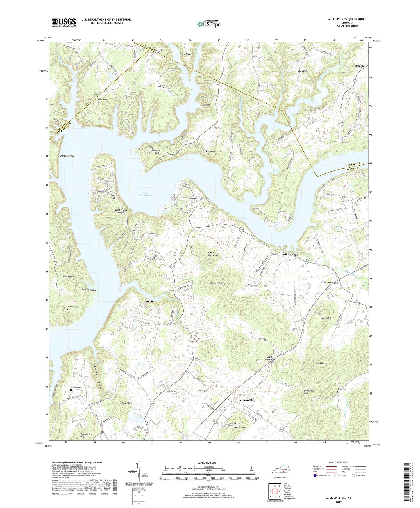
2022 topographic map quadrangle Mill Springs in the state of Kentucky. Scale: 1:24000. Based on the newly updated USGS 7.5' US Topo map series, this map is in the following counties: Wayne, Pulaski, Russell. The map contains contour data, water features, and other items you are used to seeing on USGS maps, but also has updated roads and other features. This is the next generation of topographic maps. Printed on high-quality waterproof paper with UV fade-resistant inks.
Quads adjacent to this one:
West: Jabez
Northwest: Eli
North: Faubush
Northeast: Delmer
East: Frazer
Southeast: Coopersville
South: Monticello
Southwest: Parnell
This map covers the same area as the classic USGS quad with code o36084h7.
Contains the following named places: Bee Lick Creek, Boston Hill, Chapel Hill, Clebitt Hill, Conley Bottom Dock, Cub Creek, Cub Creek Hill, Cumberland Cemetery, Cumberland Point, Cumberland Point Recreation Area, Cumberland Ridge, Davis Hollow, Daws Ridge, Dodson Cemetery, Dry Branch, Fall Creek, Fall Creek Church, Fall Creek Recreation Area, Faubush Creek, Gap of the Ridge, Hannah Hill, High Rock Hill, Hoozer Hill, Laurel Fork, Lick Fork, Little Cub Creek, Little Hannah Hill, Lockett Chapel, Meadow Creek, Mill Springs, Mill Springs Division, Mill Springs State Park, Morrow Cemetery, Morrow Chapel, Norman Cemetery, Norman Hollow, Oak Grove Church, Onion Point, Panhandle, Pleasant View Church, Pottershop Church, Rankin, Rankin Knob, Roger Grove Church, Shinbone Cliff, Simpson Spring, Sloan Cemetery, Smith Cemetery, Steubenville, Stillhouse Hollow, Touristville, White Oak Creek