MyTopo
Jamestown Kentucky US Topo Map
Couldn't load pickup availability
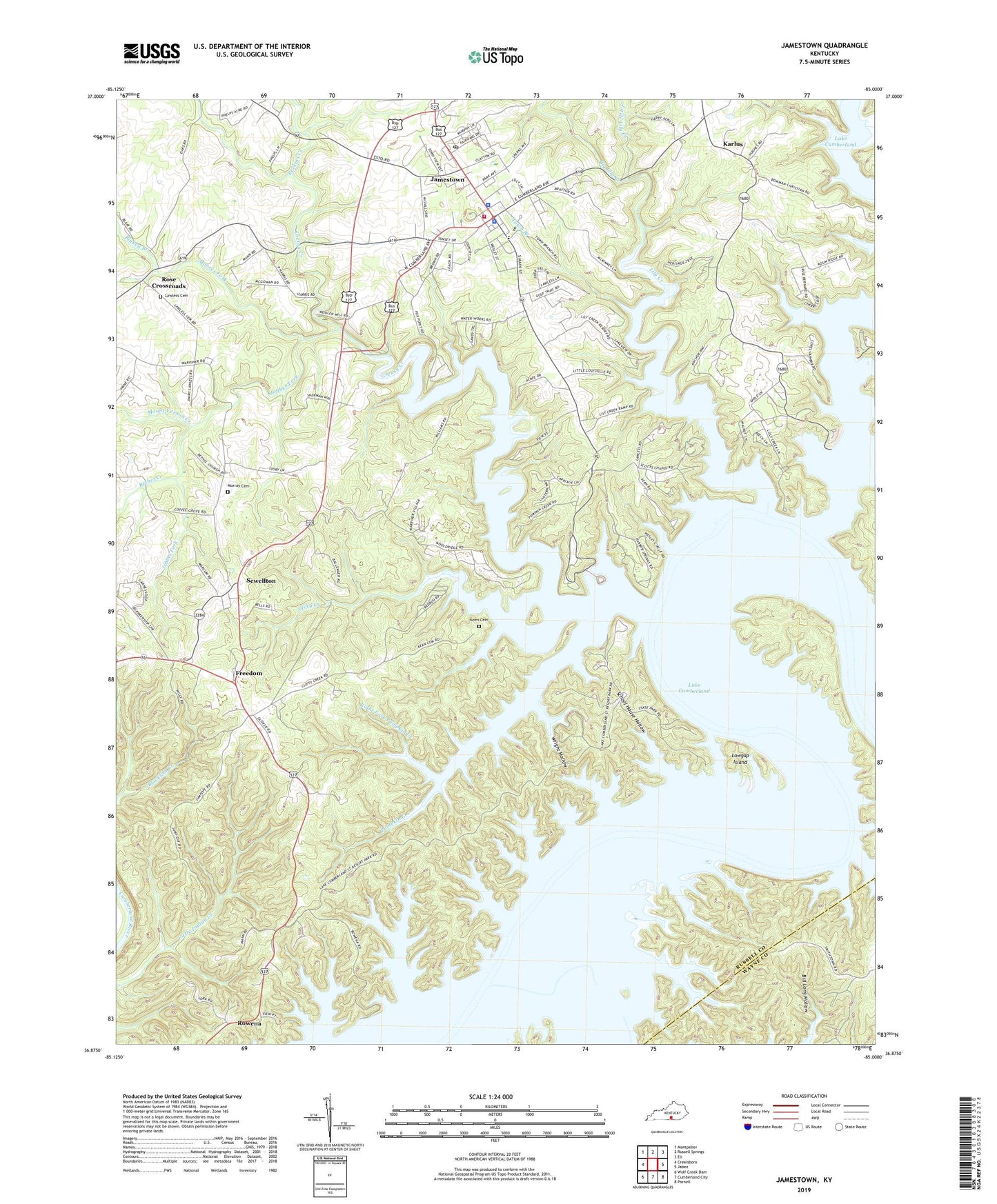
2022 topographic map quadrangle Jamestown in the state of Kentucky. Scale: 1:24000. Based on the newly updated USGS 7.5' US Topo map series, this map is in the following counties: Russell, Wayne. The map contains contour data, water features, and other items you are used to seeing on USGS maps, but also has updated roads and other features. This is the next generation of topographic maps. Printed on high-quality waterproof paper with UV fade-resistant inks.
Quads adjacent to this one:
West: Creelsboro
Northwest: Montpelier
North: Russell Springs
Northeast: Eli
East: Jabez
Southeast: Parnell
South: Cumberland City
Southwest: Wolf Creek Dam
This map covers the same area as the classic USGS quad with code o36085h1.
Contains the following named places: Baugh Branch, Bells Chapel, Bethel Church, Bethel Creek, Big Lily Creek, Blakey Branch, Buckett Branch, Caney Creek, City of Jamestown, Clifty Creek, Concord Church, Freedom, Greasy Creek, Highway Mission, Jamestown, Jamestown Division, Jamestown Dock, Jamestown Fire Department, Jamestown Police Department, Jamestown Post Office, Jobbes Fork, Karlus, Keen Cemetery, Lake Cumberland State Park, Lawless Cemetery, Lily Creek, Little Lily Creek, Lowgap Island, Moores Fork, Moores School, Mount Vernon Creek, Murray Cemetery, Otter Creek, Perkins Creek, Pig Pen Point, Pleasant Hill Common Church, Pleasant Hill Dock, Pumpkin Creek, Right Fork Pumpkin Creek, Rose Crossroads, Rowena, Russell County, Russell County Sheriff's Office, School House Hollow, Scotts Chapel Church, Sewellton, State Dock, Town Branch, Wolf Creek, Worldridge School, Wright Hollow