MyTopo
Cumberland City Kentucky US Topo Map
Couldn't load pickup availability
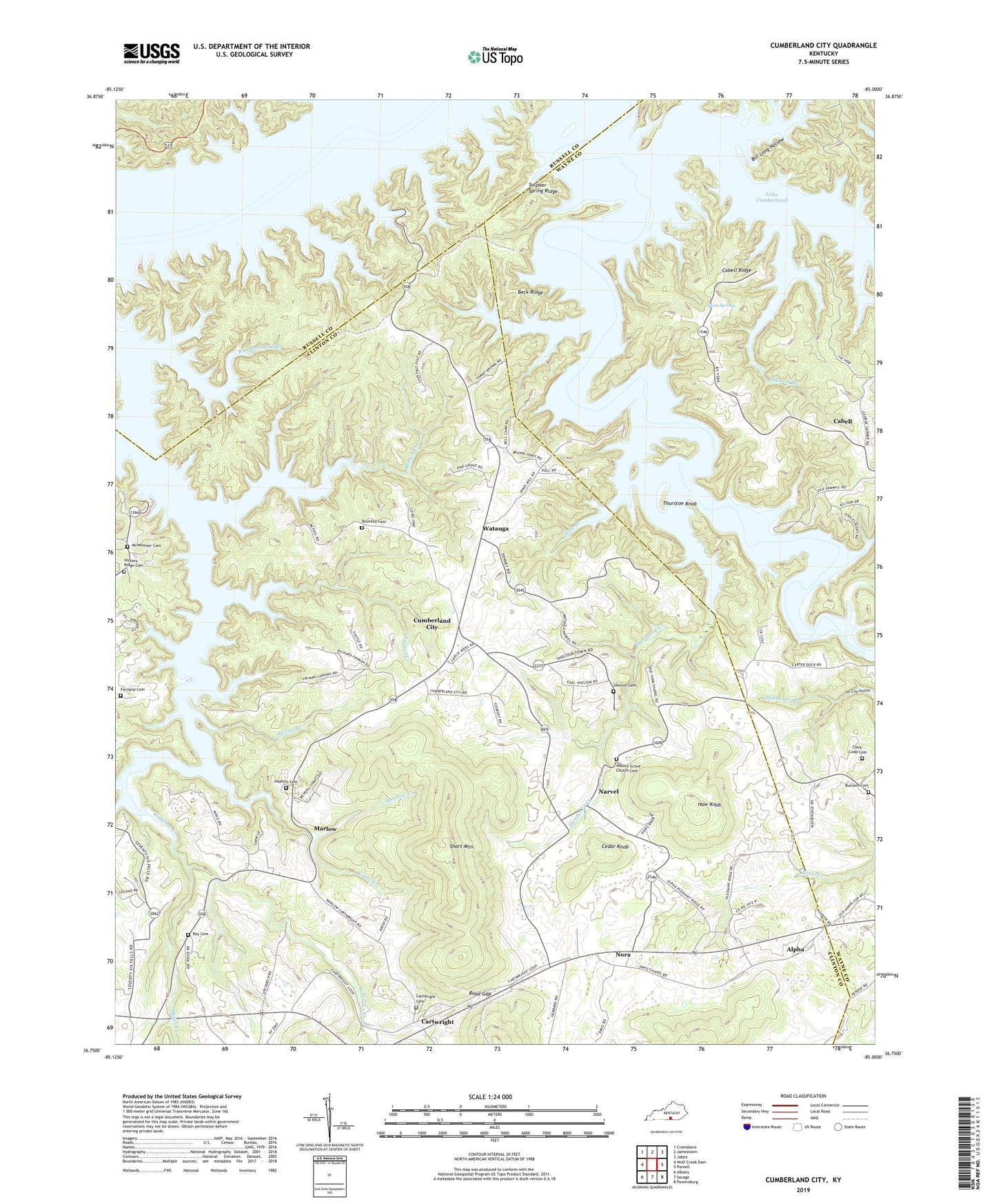
2022 topographic map quadrangle Cumberland City in the state of Kentucky. Scale: 1:24000. Based on the newly updated USGS 7.5' US Topo map series, this map is in the following counties: Clinton, Wayne, Russell. The map contains contour data, water features, and other items you are used to seeing on USGS maps, but also has updated roads and other features. This is the next generation of topographic maps. Printed on high-quality waterproof paper with UV fade-resistant inks.
Quads adjacent to this one:
West: Wolf Creek Dam
Northwest: Creelsboro
North: Jamestown
Northeast: Jabez
East: Parnell
Southeast: Powersburg
South: Savage
Southwest: Albany
This map covers the same area as the classic USGS quad with code o36085g1.
Contains the following named places: Alpha, Alpha Post Office, Beaver Creek, Beaver Creek Baptist Church, Beaver Creek Church, Beck Ridge, Becks Mill, Belt Branch, Bill Long Hollow, Brown Becks Mill, Brown Creek, Brumley Cemetery, Buncom Cemetery, Burris Mill, Cabell, Cabell Grove Post Office, Cabell Grove United Methodist Church, Cabell Ridge, Camden Post Office, Cartwright, Cartwright Cemetery, Cartwright Post Office, Carvers Mill, Cedar Knob, Cherry Grove Church, Clark-Coop Cemetery, Clarks Oilwell, Coffey Springs Post Office, Cumberland City, Cumberland City Post Office, Cumberland City School, Davis Chapel, Davis Gas Well, Dogtown, Dryden Post Office, Fairland Cemetery, Fairland Post Office, Fairview Church, Gar, Gar Post Office, Grider Hill Dock, Gross Creek, Handcock Creek, Happy Hollow, Haw Knob, Hayes Creek, Hickory Ridge Cemetery, Hopkins Cemetery, Indian Creek, Jim City Hollow, Lake Cumberland Boys Camp, Lakeview Church, Laurel Creek, Marlow, Marlow Creek, Marlow Post Office, McWhorter Cemetery, Middle Fork Indian Creek, Narvel, Narvel Post Office, Nora, Nora Post Office, Number One School, Osco Post Office, Osco School, Owens Branch, Owens School, Pine Grove School, Piney Woods, Pleasant Ridge School, Ray Cemetery, Road Gap, Shelton Branch, Shelton Cemetery, Shiner City, Short Mountain, Simpsons Branch, Slate Branch, Spout Springs, Stillhouse Branch, Sulpher Spring Ridge, The Log Chute, The Lonnie Hollow, Thurston Knob, Upchurch School, Walnut Grove Church, Walnut Grove Church Cemetery, Walnut Grove School, Watauga, Watauga Post Office, West Fork Indian Creek, Whippoorwill Creek, Wild Kitchen, Wild Kitchen School, Williams Creek, Williams School, York Chapel School, Zenobia Post Office, ZIP Code: 42603