MyTopo
Crutchfield Kentucky US Topo Map
Couldn't load pickup availability
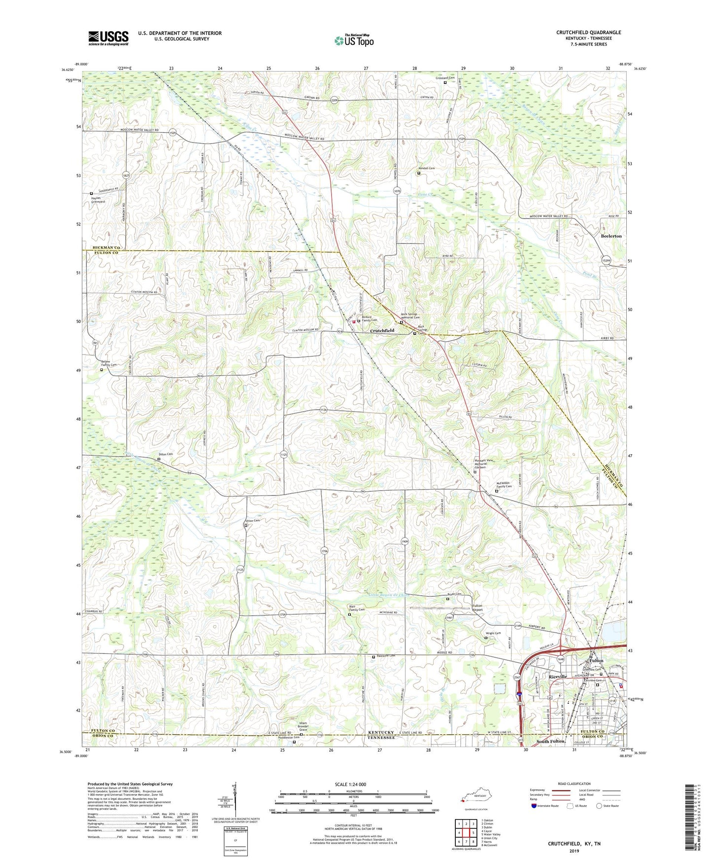
2022 topographic map quadrangle Crutchfield in the states of Kentucky, Tennessee. Scale: 1:24000. Based on the newly updated USGS 7.5' US Topo map series, this map is in the following counties: Fulton, Hickman, Obion. The map contains contour data, water features, and other items you are used to seeing on USGS maps, but also has updated roads and other features. This is the next generation of topographic maps. Printed on high-quality waterproof paper with UV fade-resistant inks.
Quads adjacent to this one:
West: Cayce
Northwest: Oakton
North: Clinton
Northeast: Dublin
East: Water Valley
Southeast: McConnell
South: Harris
Southwest: Union City
Contains the following named places: Beelerton, Bellew Family Cemetery, Binford Family Cemetery, Blair Family Cemetery, Brooks Church, Bryan Cemetery, Cane Creek, Carr Institute, City of Fulton, Crossland Cemetery, Crutchfield, Dillon Cemetery, Fairview Cemetery, Fulton Airport, Fulton Fire Department, Fulton Hospital, Fulton Police Department, Greenlea Cemetery, Harmony, Haynes Graveyard, Huddleston Cemetery, Isham Browder Grave, Kendall Cemetery, McFadden Family Cemetery, Mount Carmel Church, New Hope Church, Palestine Cemetery, Palestine Church, Parkway Regional Hospital, Pleasant View Memorial Gardens, Pond Branch, Riceville, Rock Springs Cemetery, Rock Springs Church, Rock Springs Memorial Cemetery, Sand Creek, South Fulton, South Fulton City Hall, Twin City Ambulance Service, Union, Union Cemetery, Union Cumberland Church, Water Valley Volunteer Fire Department, Wesley, Wesley Church, WKZT-AM (Fulton), Wright Cemetery, ZIP Code: 42041