MyTopo
Water Valley Kentucky US Topo Map
Couldn't load pickup availability
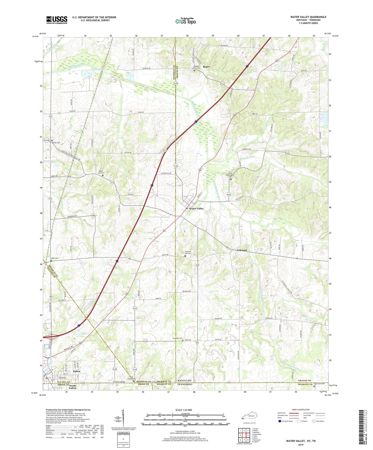
2022 topographic map quadrangle Water Valley in the states of Kentucky, Tennessee. Scale: 1:24000. Based on the newly updated USGS 7.5' US Topo map series, this map is in the following counties: Graves, Hickman, Fulton, Weakley, Obion. The map contains contour data, water features, and other items you are used to seeing on USGS maps, but also has updated roads and other features. This is the next generation of topographic maps. Printed on high-quality waterproof paper with UV fade-resistant inks.
Quads adjacent to this one:
West: Crutchfield
Northwest: Clinton
North: Dublin
Northeast: Mayfield
East: Cuba
Southeast: Latham
South: McConnell
Southwest: Harris
Contains the following named places: Bayou de Chien Church, Boaz Chapel, Boaz Chapel Cemetery, Camp Beauregard Cemetery, City of Water Valley, East Beelerton, Enon, Enon Cemetery, Feliciana, Fulton, Fulton Post Office, Jackson Creek, Lawrence Cemetery, Mount Zion Cemetery, Mount Zion Church, Oak Grove Baptist Church, Oak Grove Cemetery, Pleasant Hill Cemetery, Pleasant Valley Cemetery, Pleasant View Church, Roper, South Fork Bayou de Chien, Stephens Lake, Trinity Church, Water Valley, Water Valley Census Designated Place, Water Valley Post Office, Wesley Cemetery, ZIP Code: 42085